The figure came to light this week when the Minister for Agriculture Michael Creed, told the Dáil that his department had spent €947,000 in 2017 and €1.127m in 2016 on farm satellite inspections.
The Department of Agriculture is required to inspect 5% of all farm scheme applicants and satellite inspections have been increasingly used by the government.
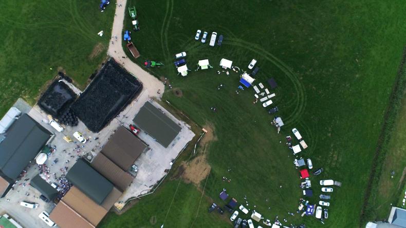
Minister Creed said: “The Remote Sensing (Satellite) inspection process involves the processing of a large range of satellite imagery received at various stages throughout the year.”
“Each case selected for inspection is then comprehensively reviewed using this imagery to ensure that the claimed area in the application form corresponds to the area farmed by the applicant, that the different crop types are as claimed and that eligible land or features are included for payment purposes,” Creed concluded.
If the satellite imagery is difficult to process, then a field visit by an inspector is required.
Satellite inspections
The Irish Farmers Journal revealed that 6,213 of the 7,111 land eligibility checks carried out in 2016 were done using satellite technology.
The remaining 898 checks were ground inspections carried out in person by a member of the Department.
Last month, farmers in Portlaoise were notified that their farms would be inspected by a delegation of officials from Brussels and Ireland who were reviewing the satellite imagery.
It is extremely likely that the Department of Agriculture and the European Commission will continue to use satellite technology to inspect farms.
Read more
Farmers 10 times more likely to be inspected in east and south
€742m in Basic Payment money paid out
Majority of farmers receive BPS advance
The figure came to light this week when the Minister for Agriculture Michael Creed, told the Dáil that his department had spent €947,000 in 2017 and €1.127m in 2016 on farm satellite inspections.
The Department of Agriculture is required to inspect 5% of all farm scheme applicants and satellite inspections have been increasingly used by the government.
Minister Creed said: “The Remote Sensing (Satellite) inspection process involves the processing of a large range of satellite imagery received at various stages throughout the year.”
“Each case selected for inspection is then comprehensively reviewed using this imagery to ensure that the claimed area in the application form corresponds to the area farmed by the applicant, that the different crop types are as claimed and that eligible land or features are included for payment purposes,” Creed concluded.
If the satellite imagery is difficult to process, then a field visit by an inspector is required.
Satellite inspections
The Irish Farmers Journal revealed that 6,213 of the 7,111 land eligibility checks carried out in 2016 were done using satellite technology.
The remaining 898 checks were ground inspections carried out in person by a member of the Department.
Last month, farmers in Portlaoise were notified that their farms would be inspected by a delegation of officials from Brussels and Ireland who were reviewing the satellite imagery.
It is extremely likely that the Department of Agriculture and the European Commission will continue to use satellite technology to inspect farms.
Read more
Farmers 10 times more likely to be inspected in east and south
€742m in Basic Payment money paid out
Majority of farmers receive BPS advance


 This is a subscriber-only article


SHARING OPTIONS: