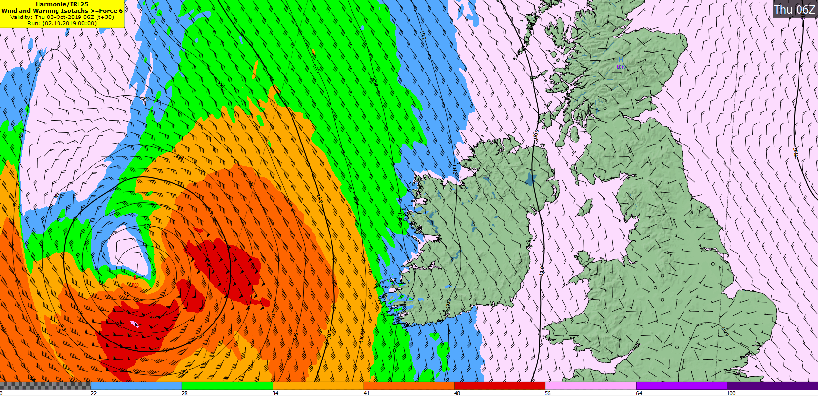
The National Emergency Coordination Group is to meet on Wednesday at 10.30am to make preparations for the expected arrival of storm Lorenzo over Ireland on Thursday. Lorenzo is currently bringing hurricane force winds to the Azores, with gusts of up to 140km/h recorded.
Met Éireann has warned that Lorenzo will accelerate northeastwards across the mid-Atlantic during Wednesday, engaging with the polar jet stream on Wednesday night, approximately 1,000km southwest of Ireland.
As Lorenzo passes over colder waters and engages with the polar jet stream, it will lose its tropical characteristics and no longer be a hurricane, but it will be a dangerous Atlantic storm.
\ Met Éireann
Accelerate
Storm Lorenzo will continue to accelerate northeastwards, with its centre approaching the west of Ireland during Thursday. If this is the case, the storm will bring high seas, severe winds and heavy rain.
Current indications from Met Éireann suggest that Lorenzo will then likely make a right turn, tracking across Ireland on Thursday night while it begins to gradually weaken.
Farmers and members of the public are being warned that trees or branches could fall as a result of the winds, especially where soils are saturated at the moment.
Weather warnings will be issued Wednesday morning.
The Department of Housing, Planning and Local Government will lead the national response to severe weather emergencies at national level.
Its emergency management team has been meeting daily and working with Met Éireann, local authorities and other government departments and agencies since last Friday about the storm and its predicted trajectory and intensity.
Expected impact
According to Met Éireann, the centre of storm Lorenzo will move east to southeastwards over Ireland on Thursday night with the strongest winds situated to the south of the storm centre. It will become very windy or stormy in Atlantic coastal counties overnight as winds veer westerly in direction.
The swathe of strong winds will then transfer eastwards across the country during the night with the risk of inland gales across parts of Connacht and Munster.
Squally bands of rain will accompany the strong winds with isolated thunderstorms possible, bringing a risk of spot flooding. Minimum temperatures of 10°C to 14°C.
Friday
Strong winds and squally rain associated with storm Lorenzo will clear during the course of Friday morning with some sunny spells developing in the afternoon.
Saturday
It is expected to be cloudy and wet for a time on Saturday with outbreaks of rain. However, drier and brighter weather will move in across the western half of the country later in the day.
Sunday
Met Éireann’s current indications suggest Sunday will be a mixed day with some sunny spells but also a few showers.
Extended outlook
It is expected to remain unsettled in the outlook period with further spells of wet and windy weather extending across Ireland from the Atlantic.
Read more
Generators at the ready as Storm Lorenzo approaches
Prepare now for hurricane Ophelia
Tips for livestock safety as hurricane Ophelia approaches


 This is a subscriber-only article


SHARING OPTIONS: