




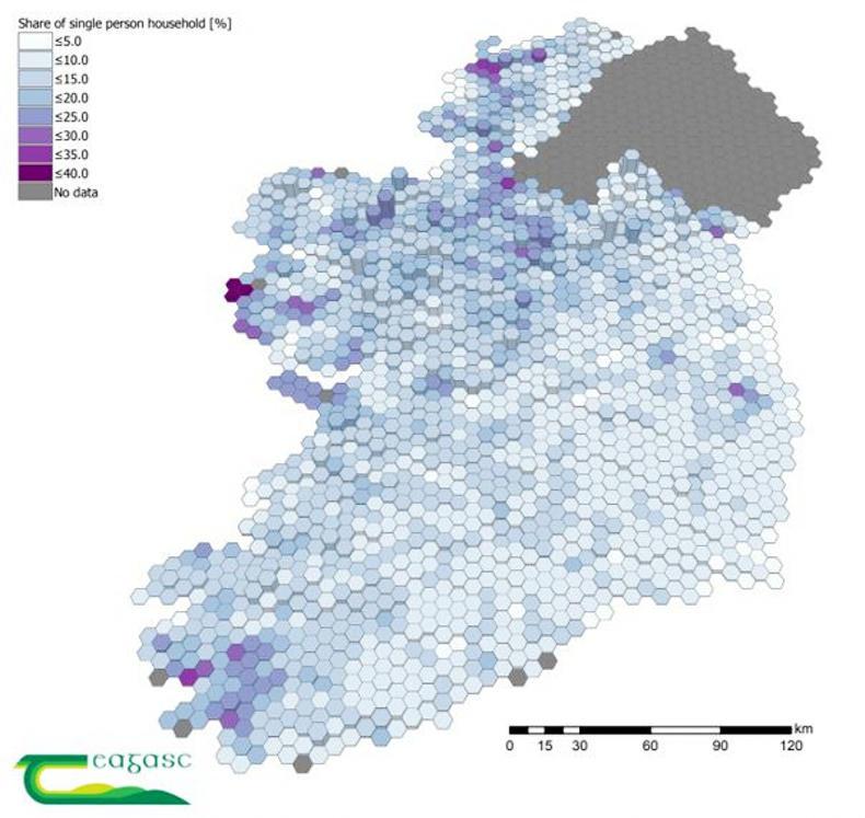
The potential for rural isolation among farmers is highest in the west of Ireland, where there is the greatest proportion of single person farms.
A map produced by Teagasc shows most of these at risk farms are concentrated in Donegal, Mayo, Galway, Sligo, Cavan, northwest Leitrim, and southwest Kerry. In Sligo and west Connemara the number of single person farms was above 40%.
The darker the shading in a hexagon the higher the proportion of single person farms. The height of the hexagon indicates the total number of farms in the area.
Geography
The map shows a clear geographical divide between the east and west, with the exception of a number of areas in Wicklow. In general, the patterns displayed corresponded well with areas regarded as remote and poorly assessable, such as mountain ranges and islands.
Other factors contributing to potential isolation are the quality of rural transport services, the cohesion of the community and individual characteristics.



SHARING OPTIONS