

Monday will be mostly dry with sunny spells, however patchy light rain or drizzle will affect parts of the west and north, mainly along coasts. Highest temperatures will be between 18°C to 22°C with mostly moderate southwest breezes.
Monday night will be mild and dry with a mix of cloud and clear spells. Some patches of mist or fog will develop and lowest temperatures will be between 12°C or 13°C.
Tuesday will be warm and dry for most of the day with the best of the sunshine in the east.
Conditions will be less favourable for the western coast, with cloud and rain developing along this coast by early evening. It will push further inland through the evening. Highest temperatures of 19°C to 24°C with moderate to fresh southerly winds. However, heavy rain will slowly spread eastwards overnight.
Rain will gradually clear from the east of the country on Wednesday during the morning and brighter conditions will extend from the west in the afternoon. Temperatures will be lower, between 17°C and 20°C, and the wind will become westerly in direction.
Thursday will be mainly dry and bright with highs of 17°C to 19°C, while conditions will turn on Friday, with mainly showers expected.
Rain
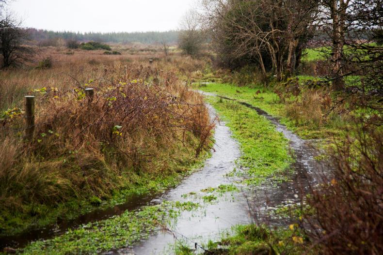
According to Met Éireann's farming forecast, rainfall over the past 7 days was well above average across the bulk of the country. Parts of the mid-west recorded twice the average rainfall amount, while in areas close to the northwest coast, rainfall was well below the norm. In contrast to this, rainfall in the coming seven days is expected to be below average except along parts of the west coast and in some northwestern areas, while parts of the southeast are likely to see below half their normal rainfall.
Temperatures
Mean air temperatures during the past week were in or around normal for late August. And little change is expected in the week ahead with profiles around normal or slightly above. Mean soil temperatures remain above normal everywhere by between 1.0°C and 2.5°C, and these also will see little change.
Drying conditions
Drying conditions will vary over the next week but there will be periods of good drying away from the bands of rain which will cross the country from time to time. The most rainfall is expected in western counties so drying will be poorest here.
Spraying
There will be reasonable opportunities for effective spraying during the early part of the week ahead, as winds will be relatively light. However, increasing wind and increasing changeability will hamper operations after Tuesday.
Field conditions
Most soil types are trafficable over the midlands and east of the country, but some reduced trafficability is likely in western and northwestern counties, especially in poorly drained soils.


SHARING OPTIONS