

A new map by Teagasc shows rural isolation in Ireland, with Teagasc cartographer Dr Stuart Green highlighting a 2km circle around every home in the country.
“The map is intended to show rural isolation, using as an indicator a 2km circle around every home in the country (our new personal geographic boundary). In this 2km boundary we counted the number of other houses (and did this for every house in the country),” Dr Green said.
There is 1,200ha inside a 2km circular area, with the map showing where each household has fewer than 20 neighbours.
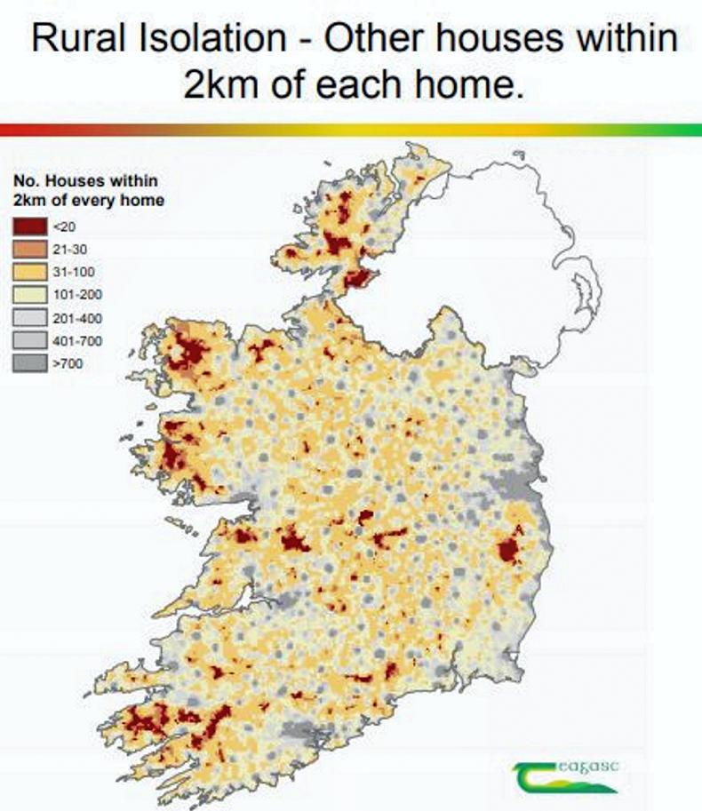
“In a city or town, even when staying at home, there are neighbours next door, people walking past the window – someone to talk to over the garden fence. In these remote areas, being at home means real isolation.
“These areas are remote, not only from neighbouring houses but all kinds of services and therefore pose particular issues adhering to the new social distancing/cocooning rules,” he said.
Parts of the map along the western seaboard and Wicklow Mountains show deep red when there are less than 20 houses in the 2km zone.


SHARING OPTIONS