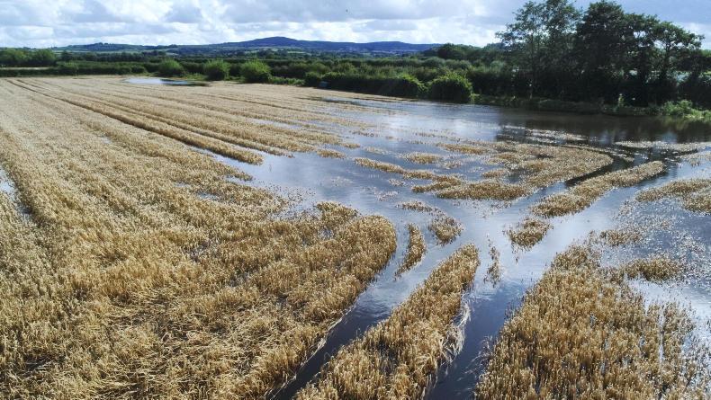
The month of August began dry, but conditions soon went awry, with the most of the first three weeks unsettled.
Heavy rain and thundery showers dominated much of the landscape.
Some dry weather appeared at the beginning of the fourth week, providing settled conditions until 26 August. However, wet weather fronts soon encroached again, with heavy rain largely affecting the west and northwest.
Rainfall and temperature averages
The Met Éireann report for August shows that the highest monthly rainfall was recorded at Athenry, Co Galway, at 297.3mm, 276% above the long-term average (LTA).
Newport, Co Mayo, witnessed the highest daily rainfall with 48.7mm on 30 August, and Newport had its wettest August since 1998.
The number of wet days ranged from 12 at Roche’s point, Co Cork, to 26 days at some weather stations.
Temperatures
Nearly all temperatures were above the LTA, with the highest temperature of the month recorded on 2 August at Mount Dillon, Co Roscommon, at 25.4°C. In contrast, the lowest temperature for the month was 4.6°C at Claremorris, Co Mayo.
No air or ground frost was reported throughout the month. However, a notable number of lightning strikes were detected on six days: 4, 5, 8, 9, 10 and 12 August.
Silage and harvest progress
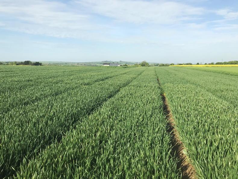
The heavy persistent rain throughout the month proved challenging for many tillage farmers attempting to harvest spring barley crops. Farmers harvesting second- and third-cut silage were also affected, with ground conditions becoming increasingly difficult.
Read more
Liffey Meats injunction hearing deferred in High Court
Protesters meet to appoint spokespeople
Legal explainer: what do court injunctions mean for protesters?
Weekly weather: changeable week ahead
The month of August began dry, but conditions soon went awry, with the most of the first three weeks unsettled.
Heavy rain and thundery showers dominated much of the landscape.
Some dry weather appeared at the beginning of the fourth week, providing settled conditions until 26 August. However, wet weather fronts soon encroached again, with heavy rain largely affecting the west and northwest.
Rainfall and temperature averages
The Met Éireann report for August shows that the highest monthly rainfall was recorded at Athenry, Co Galway, at 297.3mm, 276% above the long-term average (LTA).
Newport, Co Mayo, witnessed the highest daily rainfall with 48.7mm on 30 August, and Newport had its wettest August since 1998.
The number of wet days ranged from 12 at Roche’s point, Co Cork, to 26 days at some weather stations.
Temperatures
Nearly all temperatures were above the LTA, with the highest temperature of the month recorded on 2 August at Mount Dillon, Co Roscommon, at 25.4°C. In contrast, the lowest temperature for the month was 4.6°C at Claremorris, Co Mayo.
No air or ground frost was reported throughout the month. However, a notable number of lightning strikes were detected on six days: 4, 5, 8, 9, 10 and 12 August.
Silage and harvest progress
The heavy persistent rain throughout the month proved challenging for many tillage farmers attempting to harvest spring barley crops. Farmers harvesting second- and third-cut silage were also affected, with ground conditions becoming increasingly difficult.
Read more
Liffey Meats injunction hearing deferred in High Court
Protesters meet to appoint spokespeople
Legal explainer: what do court injunctions mean for protesters?
Weekly weather: changeable week ahead


SHARING OPTIONS