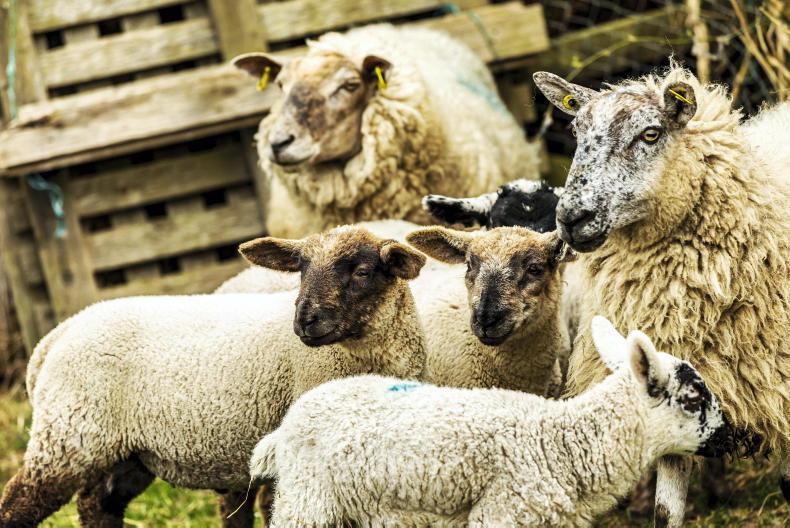
On Tuesday, the Department of Agriculture published the final map outlining which areas will face a maximum derogation stocking rate cut to 220kg organic N/ha.
Read on to find out how you can see if your farm lies within an area which will be reduced to 220kg N/ha from 2024.
The maps are most easily accessed on a computer or laptop.
Step 1: Go to the interactive map viewing portal used by the Department of Agriculture to display the final map which outlines the areas facing the maximum derogation stocking rate cut to 220kg N/ha from 2024.
The interactive portal can be found here.
Step 2: Data must be downloaded on to the device you are using to view the 220kg N/ha areas on the map.
This data can be downloaded here.
Step 3: Return to the map-viewing portal and click on the ‘add data’ icon which is located towards the top left of the screen.
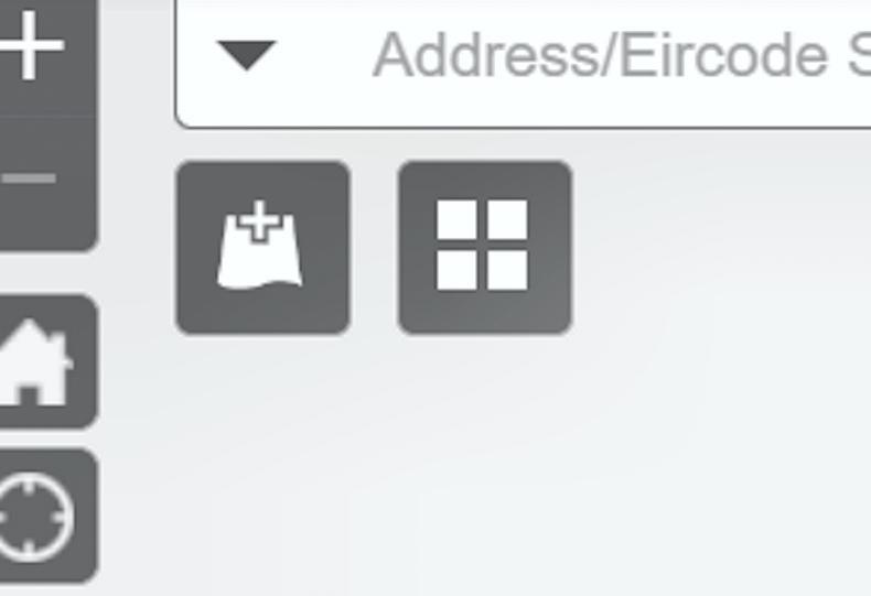
The 'add data' icon shows a plus
Step 4: In the drop-down box which appears, select ‘file’ and click on ‘browse’.
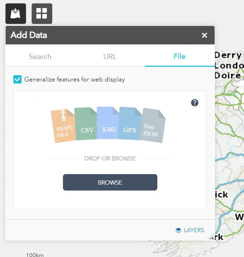
Clicking 'browse' within the 'file' section of the 'add data' drop-downn menu will take you to your device's file list.
This will bring up a list of your device’s file. Click on the recently downloaded data file.
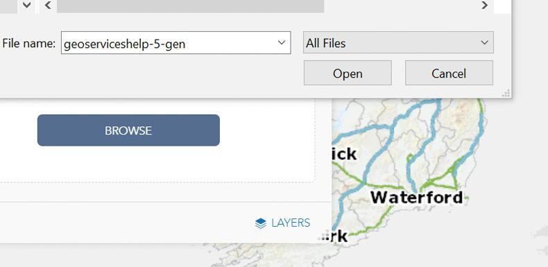
The data's file name should appear as above. Click 'open' after selecting from the list of your files.
Step 5: Return to the main map and use the mouse to scroll down to your area. The purple area which appears over the map shows which areas are facing the reduction to 220kg N/ha.
It may be easier to click on the ‘baseline map’ icon and change the map from a standard view to one of the satellite photograph views which can allow you to see the purple zones on an field-by-field basis.
Step 6: If you are a derogation farmer stocked above 220kg N/ha and you find your land located within the 220kg N/ha purple zone, you can consider some of the options available to you to comply.
The Irish Farmers Journal compiled a nitrates derogation calculator which gives a guide of the changes you may need to consider to comply with the new stocking rate limit. It can be found here.
The calculator can give you an idea of the cow reduction, volume of slurry exports or additional land you may need to source to come within the new 220kg N/ha limit from 2024.
Read more
Revealed: final derogation map showing areas cut to 220kg N/ha
On Tuesday, the Department of Agriculture published the final map outlining which areas will face a maximum derogation stocking rate cut to 220kg organic N/ha.
Read on to find out how you can see if your farm lies within an area which will be reduced to 220kg N/ha from 2024.
The maps are most easily accessed on a computer or laptop.
Step 1: Go to the interactive map viewing portal used by the Department of Agriculture to display the final map which outlines the areas facing the maximum derogation stocking rate cut to 220kg N/ha from 2024.
The interactive portal can be found here.
Step 2: Data must be downloaded on to the device you are using to view the 220kg N/ha areas on the map.
This data can be downloaded here.
Step 3: Return to the map-viewing portal and click on the ‘add data’ icon which is located towards the top left of the screen.
The 'add data' icon shows a plus
Step 4: In the drop-down box which appears, select ‘file’ and click on ‘browse’.
Clicking 'browse' within the 'file' section of the 'add data' drop-downn menu will take you to your device's file list.
This will bring up a list of your device’s file. Click on the recently downloaded data file.
The data's file name should appear as above. Click 'open' after selecting from the list of your files.
Step 5: Return to the main map and use the mouse to scroll down to your area. The purple area which appears over the map shows which areas are facing the reduction to 220kg N/ha.
It may be easier to click on the ‘baseline map’ icon and change the map from a standard view to one of the satellite photograph views which can allow you to see the purple zones on an field-by-field basis.
Step 6: If you are a derogation farmer stocked above 220kg N/ha and you find your land located within the 220kg N/ha purple zone, you can consider some of the options available to you to comply.
The Irish Farmers Journal compiled a nitrates derogation calculator which gives a guide of the changes you may need to consider to comply with the new stocking rate limit. It can be found here.
The calculator can give you an idea of the cow reduction, volume of slurry exports or additional land you may need to source to come within the new 220kg N/ha limit from 2024.
Read more
Revealed: final derogation map showing areas cut to 220kg N/ha


SHARING OPTIONS