


The talking and adjustments have come to an end. More than 8,500 farmers, who are thought likely to be affected by greening with more than 10ha of crops, will receive printed maps and a handbook of guidelines in the coming days. This also means that individual farmers who will have a crop diversification and/or ecological focus area (EFA) obligation can look to see where they stand relative to last year’s application details.
The finalisation of the online map adjustments means that farmers can now check and adjust the final version of their online details for each parcel. It also means that these farmers will receive over 100,000 maps, one for each individual parcel included on last year’s applications.
But these are last year’s parcels and individual growers may have some different parcel use or new parcels this year, which may or may not be assessed for EFA. This is just one of the many reasons why the process of cross-checking EFA needs to be done as quickly as possible. It is especially important if you are depending on landscape features to fulfil your EFA obligation.
This article follows a recent conversation with Teagasc’s Ivan Whitten. Ivan gave me the basic guidelines as to what farmers will see and what they will have to do on the online system. It describes what is involved in the application process and the key differences that now apply relative to other years.
There will be quite a number of people who must apply online for the first time this year, as all greening applications must be made online.
While maps can now be inspected and edited, it will not be possible to enter your parcel use details for your 2015 application until next month. But this is a relatively straightforward process in comparison with cross-checking your EFA details.
To help with this process, agents representing a number of growers are being given a “traffic-light” screen to highlight the farmers that are currently not thought to be compliant with either crop diversification or EFA, or are very close to the thresholds involved.
Entry process
When you go online, either on your own or with your agent, the entry process is the same as previous years. You enter via the different login security processes and then choose Single Farm Payment from the agfood Services menu.
The first screen (see Figure 1) shows the pot of entitlements you had last year, as well as a list of correspondence. This screen will also show, based on the total area and parcel use you submitted in 2014, two new boxes under the label greening, one of which relates to crop diversification; the other relates to EFA.
Each box will state if, based on last year’s details, you have a crop diversification or EFA obligation and it will also say whether the details submitted in 2014 meet each of these requirements or not. Where this says “Green by Definition”, the requirements would be met if the land use was the same as last year and if the EFA allocation for each parcel is correct (Figure 1).
This is your starting point but you will not know the exact situation until you submit all the details of your 2015 application because parcel use may change and this could impact either way on both of these obligations. Regardless of what your screen says now, your final compliance is only known after you enter all of your 2015 details.
Crop diversification
This is the two- or three-crop rule, depending on your details and whether or not you are eligible for a derogation or whether you intend to opt for an equivalence measure under GLAS. An equivalence measure is one that is deemed to offer as much or more benefit to the environment than having additional crops.
Assuming you are tillage only, and not eligible for a derogation, then if you have more than 10ha you must have at least two different crops. And if you have more than 30ha then you must have three or more crops. The only exception is for farmers who opt to use the equivalence measure of planting green cover post-harvest and leaving it in situ over winter.
But it now seems that the Commission is insisting that all of the cropped arable land on the application be planted to green cover under this measure, rather than just a proportion. This means that a grower with winter and spring crops cannot avail of this option unless the cropping programme is changed to spring-only crops.
If you hit “View>>” in the coloured crop diversification box (Figure 1) a screen will open showing the current makeup of the area of different crops submitted. Here you will also see the percentage thresholds of the main crop or the main two crops, depending on which is appropriate.
This will also show the percentage of the land in tillage, grassland and other uses. It will also show whether you meet the different specific requirements for crop percentages etc and provide reasons why you might have failed.
If you have the appropriate number of crops, or more, and if the area of these crops is within the various thresholds, the greening box will show as “3 Crop: ?”. This indicates that the cropping programme entered meets all of the requirements of crop diversification. Remember, this could change when the 2015 details are entered.
Further down, this screen shows the areas you have submitted under the different crop categories of arable crops, temporary grassland, permanent pasture and other land uses. You can change any of the crop areas here and then press the calculate button at the bottom to see if this new area makes you compliant or not.
Ecological focus area
The second new box is for EFA obligation. All farmers with more than 15ha of arable crops are obliged to have EFA unless they are entitled to a derogation. In this case arable crops includes temporary grassland so if a farmer has 85ha of cereals plus 15ha of temporary grass the EFA applies on the 100ha, which means at least 5ha of EFA.
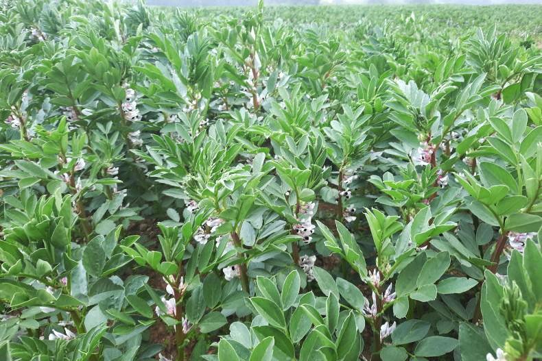
EFA can be generated from landscape features such as hedges, ditches and buffer zones beside watercourses. There are other smaller items also such as copse, coppice etc. While these features may not yield sufficient EFA, land parcels can be used in fallow or to grow peas or green cover. Fallow gives a hectare of EFA per hectare of land while protein crops (beans, peas or sweet lupins) only give 0.7 and the cover crops only give 0.3.
Where landscape features are used, different multipliers are used for different features, with a hedge awarded 5m2 on either side, an open drain getting 6m2 per metre of length and a buffer along a watercourse getting 9m2 per metre length.
Other features get different allowances also, and these can be found in the handbook when it arrives.
When you go into your online details if you press the “View>>” tag in the EFA box in Figure 1 it will open up a new screen. This will show a summary of all of the different EFA features and crops currently entered on your parcels. These are shown in Table 1.
Further down this screen is a list of all the parcels currently entered on your application. As stated before, some of these may change in 2015 so your initial assessment may not be your final assessment. The details provided for every parcel include its area, the EFA arising from hedges, drains and buffer strips, its use in the relevant year, the EFA area arising from this use and the total EFA area arising from that parcel. There is also a tick box to indicate if this parcel is to be used to subsequently generate EFA through the planting of green cover.
The estimated area of EFA arising from eligible features is initially the computer-generated assessment. This needs to be checked and changed if necessary. With the details of each specific parcel there is a little “?” symbol and if you click on this it will open the map for that parcel. Here you can see the parcel outline, hedges, drains, buffer zone, etc.
Any parcel can only be used to provide one EFA measure per year, eg fallow cannot be sown to a cover crop late in the season to provide additional EFA but it can, of course, be sown to a cover crop to just protect or improve the land.
When you open a parcel map you can see different numbers and colours around its boundary. Beneath the map there will be a number of rows with features that relate to the different elements in this parcel. These will highlight on the map when the “Select” button is pressed for any feature so you can see and adjust as necessary. The EFA factor is shown for each item. A factor of six is a drain while the fives are half hedges.
Maps
Every tillage parcel in the country will have a new map in 2015. This will include the area under hedges and ditches within the area of the fields but it will exclude any ineligible features.
The parcel shows the last four digits of the LPIS number (Figure 2) and a lot of new numbers that apply to sections of the surrounding hedges, drains and buffer strips. (There is no buffer strip in Figure 2). Each of these new identifiers can be clicked on and many can be edited. For example, if an open drain shown on the map is now filled in, it must be removed from the map.
The features shown on the map are computer-generated and so may not be totally accurate. Already many errors have been found. Examples include the insertion of hedges where they do not exist such as by farm roadways or on previously split parcels. In some instances a watercourse buffer has not been fully inserted by a major river. And ditches have been placed at the wrong side of hedges, thus allocating surplus EFA to one parcel while having insufficient in another.
These things must now be checked. Having a paper map in your hand will make it easier, but it is still a big job.
Hedges are still a bit uncertain but the definition is much more tolerable than was previously indicated. Gaps within a generally woody hedge are allowed and briars can be part of a gappy area. But gaps at the beginning or end of a marked hedge cannot be included. So if H59 in Figure 2 has 20m with no obvious woody content at the beginning of its 302.72m length and 30m blank at the other end, then only 252.72m of that hedge can be used for EFA.
The maps show most, but not all, watercourses marked in with the buffer zone also shown. However, if one needs to mark an additional buffer zone which is not marked on the map, or if a watercourse has been removed (eg piped in recent years), this cannot be done online. Such adjustments to watercourses can only be made by Department staff. Where changes to watercourse features are needed, these must be noted in the submission and a screen shot of the relevant parcel uploaded with the submission.
If you want to select a feature for alteration, just press the “Select” feature button in the right-hand column. That opens the feature for editing and displays it more easily on the screen.
If a marked hedge or ditch does not exist, it can be deleted by selecting the feature and hitting the “Delete” button on the right of the screen. If you need to alter a hedge or ditch, you must click the “Modify” button for that specific entity and then either adjust the “Eligible hedge (%)” or the “Effective Length (m)” (see Figure 3). Changes to these will alter the amount of EFA supplied by this feature.
Make these changes now
All farmers should check their maps as soon as possible and get essential changes made before the season and the advisors get too busy. Being greening-compliant is an essential part of your 2015 application.


SHARING OPTIONS