Monday will be another warm and sunny day with highs of 20°C to 25°C. The sunshine will become hazier across more northern parts as cloud increases with more overcast conditions persisting near the northwest coast.
It will be dry again tonight with some fog patches developing in places. Lows of 10°C to 14°C.
Met Eireann has forecast a warm and humid Tuesday with hazy sunshine and highs of 19°C to 26 °C in southeasterly breezes. Isolated thunderstorms will develop in the south of the country towards evening and gradually spread northwards on Tuesday night.
Wednesday will be another warm day with hazy sunshine and highest temperatures of 20°C to 26°C. However the heat and humidity will set off a number of heavy thundery showers during the day and these will continue to occur into the evening time as well.
Mostly dry then on Thursday but also much fresher with highs of 17°C to 21°C in southwesterly breezes. Spells of sunshine and cloudier periods.
On Friday we will see further cooling with temperatures back to more normal values of 15°C to 18°C. There will be a general increase in cloud and this will bring occasional patchy rain.
Saturday is expected to be mainly dry, with rain spreading eastwards on Sunday. Highs of 13°C to 17°C at the weekend.
Rain
Rainfall has been below to well below average over much of the country for the past week, with the exception of northwest Connacht and west Ulster where rainfall has remained near average or slightly above.
High pressure has become more dominant in recent days and with this situation continuing over the next few days. It will thus be much drier than normal for the first half of this week as a result. However, a return to a more mobile Atlantic flow is expected from around midweek onwards with showers or longer spells of rain at times.
Forecasted accumulations over the coming week will vary reflecting the scattered nature of the precipitation, but it will be mostly drier than normal over the bulk of country, generally 40 to 80%. Exceptions to the rule will be the coastal fringes of Connacht, West Munster and west Ulster where about 150% of the normal rainfall is expected over the coming week.
Temperatures
The next few days will see some very warm temperatures, particularly in the east and south of country but temperatures will return to more normal values later next week. Coastal locations will be closer to normal due to onshore sea breezes.
Sunshine
The coming week is likely to see higher than average sunshine in the south and southeast but less than average sunshine amounts in northwest and north due to cloudier conditions.
Drying Conditions
Drying will be good or very good up until around midweek with little or no rain in the forecast and warm sunshine expected. A deterioration is expected thereafter with a return to a more mobile Atlantic weather pattern.
Spraying
Spraying conditions look good over the next couple of days with light breezes and little or no rain. Conditions will become more sporadic as the week goes on.
Field Conditions
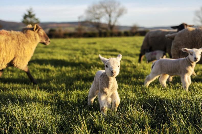
Due to the dry weather over the next few days combined with good drying conditions, the soil moisture deficits will increase. Most soils are trafficable at present.
Read more
Full coverage: Silage 2017
Monday will be another warm and sunny day with highs of 20°C to 25°C. The sunshine will become hazier across more northern parts as cloud increases with more overcast conditions persisting near the northwest coast.
It will be dry again tonight with some fog patches developing in places. Lows of 10°C to 14°C.
Met Eireann has forecast a warm and humid Tuesday with hazy sunshine and highs of 19°C to 26 °C in southeasterly breezes. Isolated thunderstorms will develop in the south of the country towards evening and gradually spread northwards on Tuesday night.
Wednesday will be another warm day with hazy sunshine and highest temperatures of 20°C to 26°C. However the heat and humidity will set off a number of heavy thundery showers during the day and these will continue to occur into the evening time as well.
Mostly dry then on Thursday but also much fresher with highs of 17°C to 21°C in southwesterly breezes. Spells of sunshine and cloudier periods.
On Friday we will see further cooling with temperatures back to more normal values of 15°C to 18°C. There will be a general increase in cloud and this will bring occasional patchy rain.
Saturday is expected to be mainly dry, with rain spreading eastwards on Sunday. Highs of 13°C to 17°C at the weekend.
Rain
Rainfall has been below to well below average over much of the country for the past week, with the exception of northwest Connacht and west Ulster where rainfall has remained near average or slightly above.
High pressure has become more dominant in recent days and with this situation continuing over the next few days. It will thus be much drier than normal for the first half of this week as a result. However, a return to a more mobile Atlantic flow is expected from around midweek onwards with showers or longer spells of rain at times.
Forecasted accumulations over the coming week will vary reflecting the scattered nature of the precipitation, but it will be mostly drier than normal over the bulk of country, generally 40 to 80%. Exceptions to the rule will be the coastal fringes of Connacht, West Munster and west Ulster where about 150% of the normal rainfall is expected over the coming week.
Temperatures
The next few days will see some very warm temperatures, particularly in the east and south of country but temperatures will return to more normal values later next week. Coastal locations will be closer to normal due to onshore sea breezes.
Sunshine
The coming week is likely to see higher than average sunshine in the south and southeast but less than average sunshine amounts in northwest and north due to cloudier conditions.
Drying Conditions
Drying will be good or very good up until around midweek with little or no rain in the forecast and warm sunshine expected. A deterioration is expected thereafter with a return to a more mobile Atlantic weather pattern.
Spraying
Spraying conditions look good over the next couple of days with light breezes and little or no rain. Conditions will become more sporadic as the week goes on.
Field Conditions
Due to the dry weather over the next few days combined with good drying conditions, the soil moisture deficits will increase. Most soils are trafficable at present.
Read more
Full coverage: Silage 2017


SHARING OPTIONS