This Monday is marked by a cold episode, especially in Ulster and north Leinster, with some frost and icy patches. Those areas are forecast to remain mostly dry, while the rest of the country is in for a rainy day, with a risk of heavy downpours, thunder and sleet elsewhere. A status yellow rainfall warning is in place until midday on Monday for Co Cork and Co Kerry. Top afternoon temperatures will range from 5°C to 9°C nationwide.
A cold, dry night is forecast again on Monday night, with low temperatures of -2°C to 2°C. Frost, ice patches, mist and fog will be followed by a wet day on Tuesday, with rain spreading through the country from the west during the day and clearing to showers over Munster and Connacht by evening. The rain will be persistent and locally heavy, with fog on hills and exposed coasts. Top temperatures will range from 7°C to 11°C as winds freshen and turn southwesterly.
Tuesday night should see the last of this week's frost with clear skies and temperatures of 0°C to 3°C.
More rain is expected on Wednesday morning, followed by showers and sunny spells in the afternoon. Temperatures will rise to between 12°C and 15°C in moderate southwest breezes.
This will set the scene for an alternation of wet and dry weather for Thursday and Friday, with temperatures ranging between lows of 3°C to 7°C and highs of 10°C to 13°C.
Rain
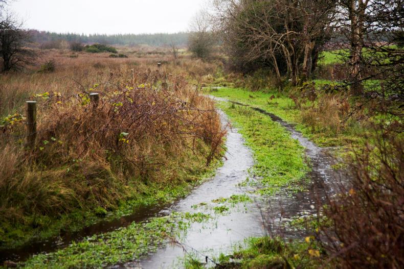
Rainfall amounts have been above average across the country over the last seven days. The wettest conditions were experienced in the southwest with Shannon Airport recording 3.5 times the normal March weekly rainfall. It was somewhat drier in the southeast, though with precipitation amounts close to normal here. It is expected to stay rather unsettled over the coming week with further rain or showers. Precipitation amounts are forecast to be close to or greater than average; the wettest conditions are expected along Atlantic coastal fringes.
Temperatures
Air temperatures have been below normal across the country over the last week. The coldest conditions were experienced in the north; Malin Head recorded a mean air temperature of 2.3°C below average. However, soil temperatures remain 1°C or 2°C above normal. It is expected to become a little milder over the coming week with mean air temperatures 1°C or 2°C above the March average.
Sunshine
Sunshine amounts have been below average across much of the country over the last seven days, with values at 80% of normal generally. The mixed and often wet weather for the week ahead will result in sunshine amounts generally below average.
Drying conditions
Drying will be poor overall with rain or showers on most days.
Spraying
Opportunities for spraying will be limited with blustery conditions persisting.
Field conditions
Further rain or showers over the next few days will result in a continued deterioration of soil conditions. This will result in most soil types becoming saturated and trafficability will be poor. Poorly drained soils are waterlogged in most areas.
Read more
February storms bring rainfall levels back up
This Monday is marked by a cold episode, especially in Ulster and north Leinster, with some frost and icy patches. Those areas are forecast to remain mostly dry, while the rest of the country is in for a rainy day, with a risk of heavy downpours, thunder and sleet elsewhere. A status yellow rainfall warning is in place until midday on Monday for Co Cork and Co Kerry. Top afternoon temperatures will range from 5°C to 9°C nationwide.
A cold, dry night is forecast again on Monday night, with low temperatures of -2°C to 2°C. Frost, ice patches, mist and fog will be followed by a wet day on Tuesday, with rain spreading through the country from the west during the day and clearing to showers over Munster and Connacht by evening. The rain will be persistent and locally heavy, with fog on hills and exposed coasts. Top temperatures will range from 7°C to 11°C as winds freshen and turn southwesterly.
Tuesday night should see the last of this week's frost with clear skies and temperatures of 0°C to 3°C.
More rain is expected on Wednesday morning, followed by showers and sunny spells in the afternoon. Temperatures will rise to between 12°C and 15°C in moderate southwest breezes.
This will set the scene for an alternation of wet and dry weather for Thursday and Friday, with temperatures ranging between lows of 3°C to 7°C and highs of 10°C to 13°C.
Rain
Rainfall amounts have been above average across the country over the last seven days. The wettest conditions were experienced in the southwest with Shannon Airport recording 3.5 times the normal March weekly rainfall. It was somewhat drier in the southeast, though with precipitation amounts close to normal here. It is expected to stay rather unsettled over the coming week with further rain or showers. Precipitation amounts are forecast to be close to or greater than average; the wettest conditions are expected along Atlantic coastal fringes.
Temperatures
Air temperatures have been below normal across the country over the last week. The coldest conditions were experienced in the north; Malin Head recorded a mean air temperature of 2.3°C below average. However, soil temperatures remain 1°C or 2°C above normal. It is expected to become a little milder over the coming week with mean air temperatures 1°C or 2°C above the March average.
Sunshine
Sunshine amounts have been below average across much of the country over the last seven days, with values at 80% of normal generally. The mixed and often wet weather for the week ahead will result in sunshine amounts generally below average.
Drying conditions
Drying will be poor overall with rain or showers on most days.
Spraying
Opportunities for spraying will be limited with blustery conditions persisting.
Field conditions
Further rain or showers over the next few days will result in a continued deterioration of soil conditions. This will result in most soil types becoming saturated and trafficability will be poor. Poorly drained soils are waterlogged in most areas.
Read more
February storms bring rainfall levels back up


SHARING OPTIONS