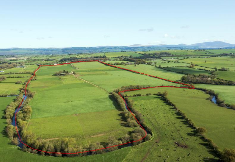
Farmers are being urged to check their land folios after information gleaned by the Irish Farmers Journal revealed that up to 4,500 mapping “errors” were made when Land Registry maps were digitised in 2005.
The details were released under a Freedom of Information request from this newspaper, and the Land Registry has said that the 4,500 errors were corrected.
However, one Galway suckler farmer has spoken of his ordeal after being the unwitting victim of the mapping errors.
We put an awful lot of work into that land. It is precious to us because as Irish people we had to fight for it
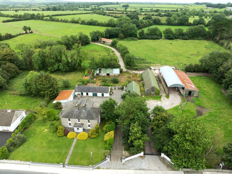
The farmer has had 20 acres of his land incorrectly added to his neighbour’s folio number, and has been struggling since 2005 to rectify the issue, despite still receiving grants from the Department of Agriculture for the land which has been in his family for generations.
“I am lucky that my neighbour has been very good about it, but legally they could go out and sell the land tomorrow,” the farmer said.
“We put an awful lot of work into that land. It is precious to us because as Irish people we had to fight for it.”
The Land Registry told the Irish Farmers Journal that the 4,500 errors had been corrected free of charge by it and that the digitisation process had revolutionised the mapping system since 2005.
It said that the reason for some of the inaccuracies include damaged map sheets and the fact that much of the mapping along the western seaboard was referencing Ordnance Survey 6” mapping, which had not been revised for decades.
However, the Land Registry was not able to state how many acres of land had been inaccurately recorded and the 4,500 figure is just the inaccuracies that have been corrected, with the potential that there are more in the system.
Read more
Map: Teagasc researchers use placenames to reveal past farming activity
Department mapping Ireland’s farmland and bogs
Farmers are being urged to check their land folios after information gleaned by the Irish Farmers Journal revealed that up to 4,500 mapping “errors” were made when Land Registry maps were digitised in 2005.
The details were released under a Freedom of Information request from this newspaper, and the Land Registry has said that the 4,500 errors were corrected.
However, one Galway suckler farmer has spoken of his ordeal after being the unwitting victim of the mapping errors.
We put an awful lot of work into that land. It is precious to us because as Irish people we had to fight for it
The farmer has had 20 acres of his land incorrectly added to his neighbour’s folio number, and has been struggling since 2005 to rectify the issue, despite still receiving grants from the Department of Agriculture for the land which has been in his family for generations.
“I am lucky that my neighbour has been very good about it, but legally they could go out and sell the land tomorrow,” the farmer said.
“We put an awful lot of work into that land. It is precious to us because as Irish people we had to fight for it.”
The Land Registry told the Irish Farmers Journal that the 4,500 errors had been corrected free of charge by it and that the digitisation process had revolutionised the mapping system since 2005.
It said that the reason for some of the inaccuracies include damaged map sheets and the fact that much of the mapping along the western seaboard was referencing Ordnance Survey 6” mapping, which had not been revised for decades.
However, the Land Registry was not able to state how many acres of land had been inaccurately recorded and the 4,500 figure is just the inaccuracies that have been corrected, with the potential that there are more in the system.
Read more
Map: Teagasc researchers use placenames to reveal past farming activity
Department mapping Ireland’s farmland and bogs


SHARING OPTIONS