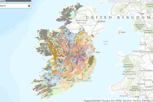
Today, Teagasc, along with the EPA, will launch the new digitised soil survey of Ireland. The Third Edition National Soil Map will, for the first time, bring together all 213 soil types that are found in Ireland and give a complete picture of the diversity and properties of Irish soils.
The information will not only help in both policy formation and research but also will help tackle the challenge of establishing the productive capacity of agricultural land in specific regions.
It will be interesting to see the correlation, if any, between soil type and profit-generating capacity of the various farm enterprises.
The five-year research programme adopted a unique methodology that combined novel digital mapping techniques with traditional soil survey application.
Of course, Teagasc has a proud history of mapping soils in Ireland. Indeed, Teagasc’s predecessor, An Foras Talúntais, was almost exclusively responsible for the first soil survey in the 1970s and ’80s, which mapped the soils of approximately half of the country. Its detailed county maps have been in great demand ever since among scientists, planners, local authorities and indeed farmers. However, when suspended in 1980, only 44% of the country was surveyed at that time. This is a hugely significant development and both Teagasc and the EPA deserve great credit for providing the sector with this valuable resource.
The Irish Soil Information System is available at http://soils.teagasc.ie


SHARING OPTIONS