

Co Monaghan is probably best known for being a land of drumlins, a feature that is common in southern Ulster. Notably, the soils and drumlins of Monaghan were often the subject of Monaghan-born poet Patrick Kavanagh, who wrote of the stony grey soils of Monaghan or about drumlins, which he described by writing “they are my Alps and I have climbed the Matterhorn”.
Drumlins formed when unsorted glacial drift was deposited as ice retreated at the end of an ice age. They generally have the form of long, relatively low, elongated hills.
Over half of Co Monaghan is characterised by drumlin areas and these are found associated with wet soils such as surface-water gleys (slowly permeable sub-surface layer). Basin peat is a common feature found in the hollows between drumlins. These features are typical of the area stretching from the north of the county to Ballybay. An exception to this is the tract running east to west, from Clones through Monaghan town to the east coast, where lowlands formed from limestone glacial till can be found, predominantly associated with luvisols (movement of clay down the soil profile).
The area between Ballybay and Carrickmacross is better described as well-drained shale hills, with glacial drift formed from sedimentary stones in the lowlands. This area is associated with brown earths on bedrock and with surface-water gleys on the glacial drift.
Another notable feature includes a chain of lakes that runs the width of the county, stretching from Rockcorry to Castleblaney. Brown earths are the most commonly found soil type in Co Monaghan. Although they can be found in areas close to Monaghan town, the majority are located south of Ballybay, where they dominate the landscape. Brown earths are typically well-draining soils with reasonable nutrient retention and are considered a farmer’s friend. All of the brown earths here are classified as ‘Ballylanders’ series (found in association 1100e led by subgroup 1100), which were originally found in Co Limerick in the in-depth 1966 soil survey by An Foras Talúntais. These brown earths tend to occur on lower slopes, but are sometimes accompanied by brown podzols on the steeper slopes.
Brown podzolic soils have lost much of their nutrients, especially iron and aluminium, as a result of acidic conditions and high rainfall over time. Consequently, these soils can be considered nutrient-poor and may benefit from liming periodically. They are naturally free-draining and should not require any additional drainage.
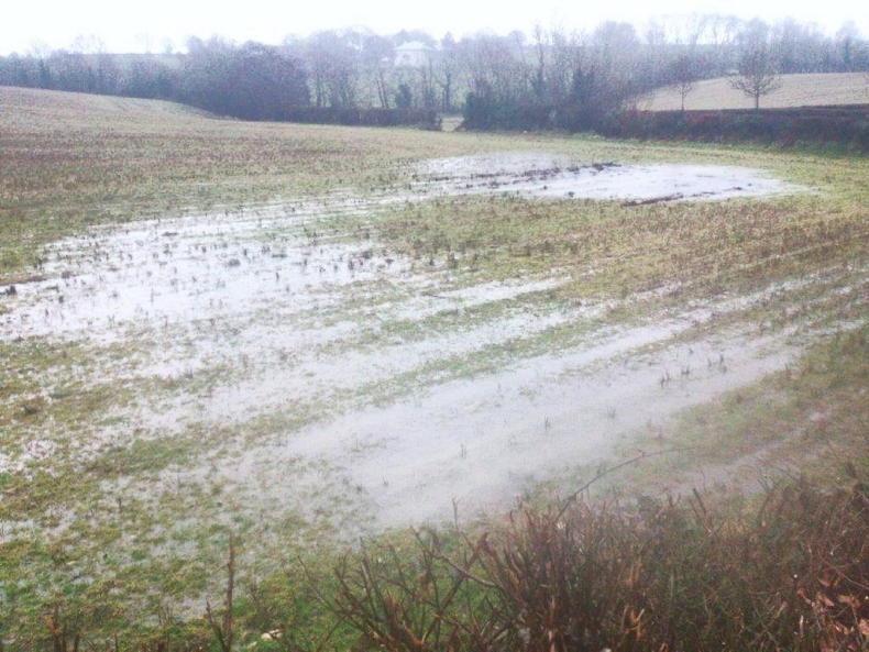
Luvisols and surface-water gleys are typical in the depressions related to fine (high clay content) textured soils on shale bedrock and on glacial drift formed with sedimentary stones. Surface-water gleys are the second most common soil type, found found mostly in the north of the county, but also in pockets towards Ballybay. These soils are found on heavy glacial till, which gives rise to heavy textured sub-soils and as a result are poorly drained, making them difficult to work with.
SHARING OPTIONS