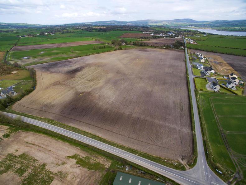
Using the Land Parcel Identification System (LPIS) departments of agriculture across EU member states can identify land parcels and in turn ensure farmers do not overclaim or underclaim direct payments.
Farmers comply with a range of schemes, many of which are aimed at reducing the impact of farming on the environment and enhancing biodiversity.
An information note from the European Commission said: “With over 22m people working in the agricultural sector in the EU, keeping track of whether these conditions are adequately met – and whether they are having the desired effect in protecting the environment and biodiversity – is of course a major challenge.
“Satellite monitoring, coupled with sophisticated software and expert knowledge, can help assess the impact of the rules – and help ensure that future rules can respond even more effectively to the evolving challenge of climate change and biodiversity loss.”
Climate change
Already satellites predict crop yields for the EU and how weather conditions are forecast to change what is happening on the ground.
More and more, satellites are being used by those in the Commission to look at climate change.
“The first half of 2017 saw many European countries affected by these adverse climatic conditions, from droughts to heavy rainfalls, depending on the region.
“This had a profound impact on crops and put many farmers under extreme financial pressure.
“The EU’s Common Agricultural Policy is there to help in such circumstances, with each national government able to grant farmers in difficulty an advance on their annual payment, if the circumstances justify it.
“This was the case for 15 different EU countries this year, and the data – illustrating the climatic conditions in the first part of the year and their impact on crops – was a vital component in this decision-making process.”
Read more
New eyes in the sky for Department
Satellite checks result in 1,000 land eligibility penalties


SHARING OPTIONS