Monday
Today will be wet and windy for a time, according to Met Éireann. Rain will extend northeastwards to all parts of the country during the morning. Brighter and drier weather will follow from the southwest in the afternoon with just a few showers. Maximum temperatures will range from 16°C to 20°C.
Monday night will see rain continue to clear northeastwards and most areas will become dry, with clear spells developing. Minimum temperatures will range from 6°C to 10°C, in mostly moderate southerly breezes.
Tuesday
Tomorrow will see a dry start in most areas, with some bright or sunny spells. Scattered showers in the southwest and west will gradually become more widespread and a spell of heavier rain will extend across much of the southern half of the country during the afternoon and evening. Maximum temperatures will range from 15°C to 19°C.
On Tuesday night there will be dry spells broken by scattered showers. Mist and fog patches will develop as winds slacken. Minimum temperatures will range from 10°C to 14°C.
Wednesday
By midweek it will be dry in many areas, but with a good deal of cloud and a few isolated showers. Outbreaks of rain will develop in west and southwest coastal areas later in the afternoon, extending gradually eastwards later Wednesday.
Maximum temperatures will range from 16°C to 29°C, in mostly light south to southwest winds, freshening as the rain arrives. Clearer conditions, with scattered showers, will follow overnight.
Thursday to Sunday
Current indications from Met Éireann suggest that there will be bright or sunny spells each day, with scattered showers. Most of the showers will be in west Ulster, Connacht and west Munster, some of them will be heavy, with a risk of thunder, especially on Friday, Saturday and Sunday.
Temperatures will be around normal, or slightly above, with maximum values of 15°C to 18°C. It will be breezy, with moderate to fresh south to southwest winds on Thursday and Friday, veering west to northwest in direction by Sunday.
Rain
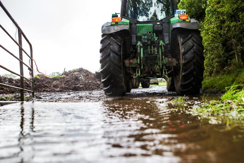
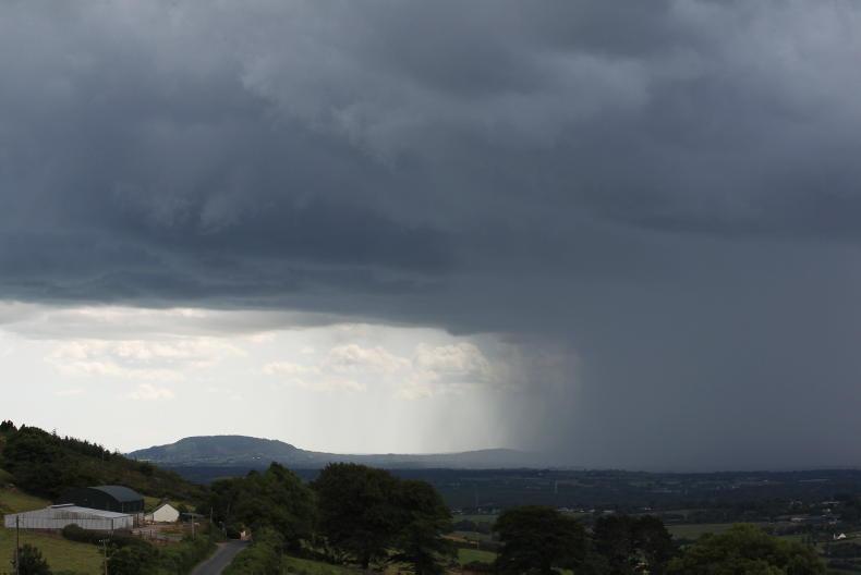
Rainfall was below average across the country last week. The unsettled conditions over the weekend will persist through the week and result in significant rainfall accumulations in some parts. While still uncertain, it is likely to be wetter than normal for most of the country, with current indications suggesting amounts between 145% and 270% of the norm over the week.
Temperatures
Soil temperatures are generally between 1°C and 3°C above average. Mean air temperatures last week were near average and this week they will be close to average or slightly above average, mainly due to milder nights.
Sunshine and drying conditions
Sunshine values are expected to decline over the coming week with increasing amounts of cloud due to unsettled weather combined with shorter days.
Drying conditions are expected to deteriorate as more unsettled weather sets in over the coming week.
Field conditions
There were some restrictions to growth in parts of Leinster and Munster last week with soil moisture deficits of 20mm to 40mm. This will improve somewhat over the coming week. Soils will, however, become saturated again in parts of the north and west.
Read more
Weekend weather: sunny spell to come to an end
Five tips to have cattle housing winter ready
Improving Irish blight forecasts
Dairy Management: vaccines, calves and collaborations
Tillage Manegement: be selective with early planted fields
Monday
Today will be wet and windy for a time, according to Met Éireann. Rain will extend northeastwards to all parts of the country during the morning. Brighter and drier weather will follow from the southwest in the afternoon with just a few showers. Maximum temperatures will range from 16°C to 20°C.
Monday night will see rain continue to clear northeastwards and most areas will become dry, with clear spells developing. Minimum temperatures will range from 6°C to 10°C, in mostly moderate southerly breezes.
Tuesday
Tomorrow will see a dry start in most areas, with some bright or sunny spells. Scattered showers in the southwest and west will gradually become more widespread and a spell of heavier rain will extend across much of the southern half of the country during the afternoon and evening. Maximum temperatures will range from 15°C to 19°C.
On Tuesday night there will be dry spells broken by scattered showers. Mist and fog patches will develop as winds slacken. Minimum temperatures will range from 10°C to 14°C.
Wednesday
By midweek it will be dry in many areas, but with a good deal of cloud and a few isolated showers. Outbreaks of rain will develop in west and southwest coastal areas later in the afternoon, extending gradually eastwards later Wednesday.
Maximum temperatures will range from 16°C to 29°C, in mostly light south to southwest winds, freshening as the rain arrives. Clearer conditions, with scattered showers, will follow overnight.
Thursday to Sunday
Current indications from Met Éireann suggest that there will be bright or sunny spells each day, with scattered showers. Most of the showers will be in west Ulster, Connacht and west Munster, some of them will be heavy, with a risk of thunder, especially on Friday, Saturday and Sunday.
Temperatures will be around normal, or slightly above, with maximum values of 15°C to 18°C. It will be breezy, with moderate to fresh south to southwest winds on Thursday and Friday, veering west to northwest in direction by Sunday.
Rain
Rainfall was below average across the country last week. The unsettled conditions over the weekend will persist through the week and result in significant rainfall accumulations in some parts. While still uncertain, it is likely to be wetter than normal for most of the country, with current indications suggesting amounts between 145% and 270% of the norm over the week.
Temperatures
Soil temperatures are generally between 1°C and 3°C above average. Mean air temperatures last week were near average and this week they will be close to average or slightly above average, mainly due to milder nights.
Sunshine and drying conditions
Sunshine values are expected to decline over the coming week with increasing amounts of cloud due to unsettled weather combined with shorter days.
Drying conditions are expected to deteriorate as more unsettled weather sets in over the coming week.
Field conditions
There were some restrictions to growth in parts of Leinster and Munster last week with soil moisture deficits of 20mm to 40mm. This will improve somewhat over the coming week. Soils will, however, become saturated again in parts of the north and west.
Read more
Weekend weather: sunny spell to come to an end
Five tips to have cattle housing winter ready
Improving Irish blight forecasts
Dairy Management: vaccines, calves and collaborations
Tillage Manegement: be selective with early planted fields


SHARING OPTIONS