

In general, the landscape of Co Limerick could be described as lowland flats. The area between Foynes and Limerick city, stretching south to the Cork border, is characterised by fertile plains of lowlands composed of limestone glacial till. Luvisol soils (downward clay movement) are readily found, but in the area between Newcastle West and Killmallock to the south, surface-water gleys (slowly permeable sub-surface layer) are more typical, interspersed with luvisols.
However, the county is not exclusively flat and the Galty (Galtee) Mountains in the southeast represent the mountainous region of the county.
Moreover, hilly areas can be found along the edge of the county, to the west of Foynes, and provide a broken border to Galbally in the east. These areas are made up of undulating wet shale, with sedimentary glacial drift.
Notably, Herbertstown, to the east of Loch Gur, is home to a volcanic ring region and has a distinctive topography, with isolated hills rising out of the lowlands. Most of the county is drained by the River Shannon and its tributaries – the Mulkear, the Maigue and the Deel.
Overall, luvisols are the most prevalent soil type found in the county. The movement of clay from the topsoil into the subsoil means that these are very good agricultural soils due to their higher clay content, as they retain nutrients well.
However, the increased clay in the subsoil can slow down the movement of water through the profile, meaning that these soils can be moderately to imperfectly draining, depending on the soil texture. The most commonly found are the ‘Elton’ series (found in associations 1000a and 1000c led by subgroup 1000).
These soils have good moisture-holding capacity, are very productive and have a wide use-range, including grazing and tillage. While these are good soils, they can have weak structure and could be prone to compaction or poaching if stocked during wetter periods.
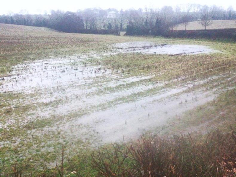
Humic surface-water gleys are found on the landscape too, particularly in the lowland areas towards the southern half of the county. Essentially, these are poorly draining soils that occur due to a slowly permeable subsurface layer that slows movement of water through the soil profile.
Seasonal waterlogging
This layer is typically due to either a higher clay content or dense material in the subsoil. This results in seasonal waterlogging for prolonged periods of the year. These are all ‘Howardstown’ series (found in association 0760c led by subgroup 0760). The soils of this series are derived from medium to moderately fine-textured calcareous glacial till. The use-range of these soils is limited due to the weak structure, slow permeability and poor drainage, but good management can facilitate optimum production. Typical surface-water gleys are also found, but these are generally in the undulating landscape of the western part of the county, which is unsurprising, as these soils are frequently found on slopes.
SHARING OPTIONS