Mist and fog will gradually lift on Monday to leave a mix of hazy sunshine and scattered thundery downpours, according to the latest forecast from Met Eireann. Feeling warm and humid with highest temperatures ranging 18°C to 22°C in mostly light, variable breezes. Mist and fog may linger along some coasts.
Isolated thunderstorms will ease to leave most areas dry on Monday night. Areas of mist and fog forming. Minimum temperatures of 10°C to 14°C in mostly light northerly breezes.
Tuesday
Mist and fog gradually lifting to leave spells of hazy sunshine and isolated thunderstorms, these are most likely to affect inland parts of Munster and south Leinster. Highest temperatures of 20°C to 23°C generally but a little cooler at the coast due to onshore breezes. Mainly dry overnight with patchy mist and fog. Minimum temperatures of 10°C to 14°C overnight in mostly light northerly breezes.
Wednesday
Mainly dry on Wednesday with spells of hazy sunshine. However, there is the risk of the odd thundery downpour, mainly in the southwest. Maximum temperatures of 20°C to 25°C generally but a few degrees cooler along northern and eastern coasts due to onshore northeasterly breezes. Largely dry overnight with just the odd shower in the south. Minimum temperatures of 10°C to 15°C.
Thursday
Mostly dry with hazy sunshine and variable cloud cover. A slight risk of an isolated thunderstorm. Feeling very warm and humid with maximum temperatures of 22°C to 27°C generally but a few degrees less along northern and eastern coasts. Largely dry overnight. Staying warm very humid overnight with lows of 15°C to 18°C in light easterly winds.
Friday
It looks set to turn exceptionally warm by Friday with spells of sunshine and just the odd thunderstorm. Very warm or hot with maximum temperatures of 24°C to 28°C widely but a few degrees less in coastal areas of the north and east in moderate east winds. Temperatures only falling marginally overnight with minimum temperatures of 15°C to 19°C, staying very humid.
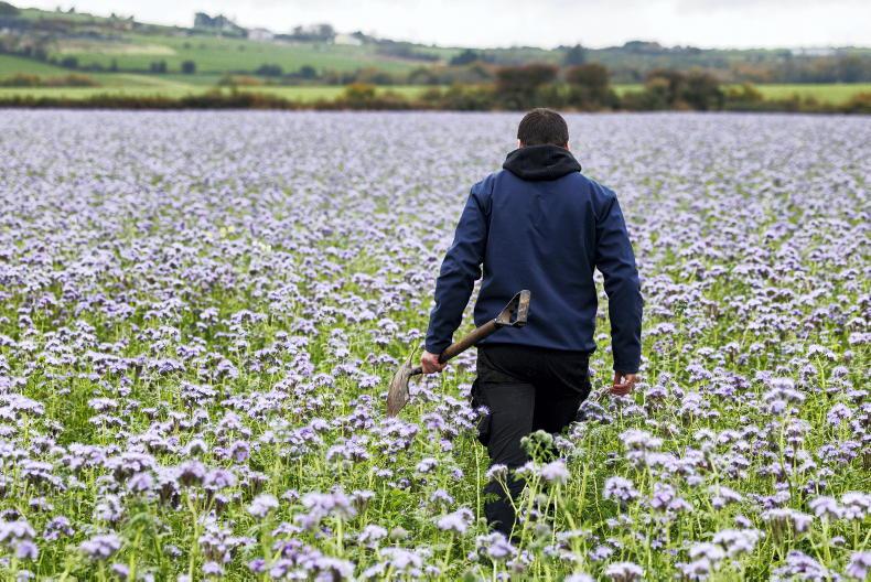
Warm and humid conditions early next week will be conducive for the spread of potato blight. Some opportunities for spraying Monday evening, Tuesday or Wednesday away from showers.
Rain
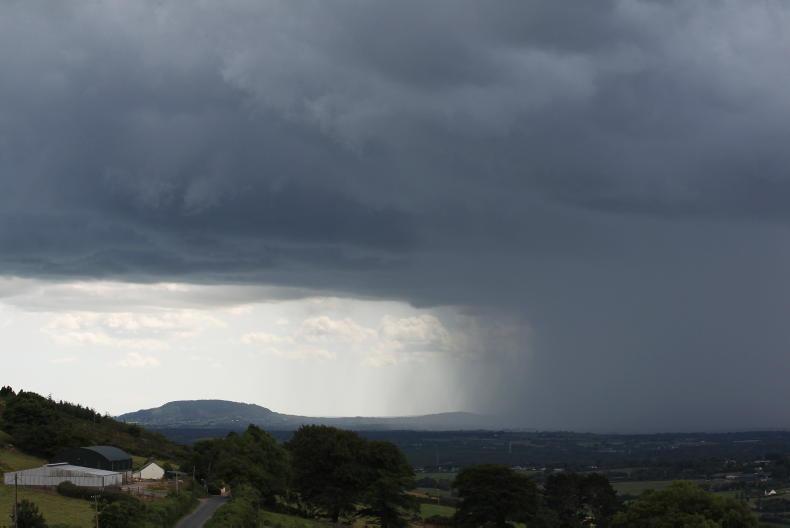
Heavy rain on Sunday cleared overnight with the risk of some scattered thundery downpours through the week but also lots of dry weather. Therefore rainfall totals this week will be highly variable once today's frontal rain clear through. Localised areas hit by heavy thunderstorms could see totals of close to 50mm but other areas generally 5-10mm of precipitation.
Temperatures
Temperatures will gradually turn warmer over the next few days, and more especially so for mid to late next week when values will get into the mid 20's or higher and nights will be warm and muggy. So over the next 7 days we can expect values to average out 3 or more degrees above normal in most areas.
Drying conditions
Drying conditions will be highly variable this week due to high humidities and heavy downpours but warm sunny periods also.
Field conditions
Most soils are trafficable. Some restriction to growth in soils in some parts of Leinster and Munster. However these deficits will improve significantly over the next week.
Read more
How tillage farmers can reduce their carbon footprint
Watch: even and accurate fertiliser spreading to feature at Crops & Spreaders
Mist and fog will gradually lift on Monday to leave a mix of hazy sunshine and scattered thundery downpours, according to the latest forecast from Met Eireann. Feeling warm and humid with highest temperatures ranging 18°C to 22°C in mostly light, variable breezes. Mist and fog may linger along some coasts.
Isolated thunderstorms will ease to leave most areas dry on Monday night. Areas of mist and fog forming. Minimum temperatures of 10°C to 14°C in mostly light northerly breezes.
Tuesday
Mist and fog gradually lifting to leave spells of hazy sunshine and isolated thunderstorms, these are most likely to affect inland parts of Munster and south Leinster. Highest temperatures of 20°C to 23°C generally but a little cooler at the coast due to onshore breezes. Mainly dry overnight with patchy mist and fog. Minimum temperatures of 10°C to 14°C overnight in mostly light northerly breezes.
Wednesday
Mainly dry on Wednesday with spells of hazy sunshine. However, there is the risk of the odd thundery downpour, mainly in the southwest. Maximum temperatures of 20°C to 25°C generally but a few degrees cooler along northern and eastern coasts due to onshore northeasterly breezes. Largely dry overnight with just the odd shower in the south. Minimum temperatures of 10°C to 15°C.
Thursday
Mostly dry with hazy sunshine and variable cloud cover. A slight risk of an isolated thunderstorm. Feeling very warm and humid with maximum temperatures of 22°C to 27°C generally but a few degrees less along northern and eastern coasts. Largely dry overnight. Staying warm very humid overnight with lows of 15°C to 18°C in light easterly winds.
Friday
It looks set to turn exceptionally warm by Friday with spells of sunshine and just the odd thunderstorm. Very warm or hot with maximum temperatures of 24°C to 28°C widely but a few degrees less in coastal areas of the north and east in moderate east winds. Temperatures only falling marginally overnight with minimum temperatures of 15°C to 19°C, staying very humid.
Warm and humid conditions early next week will be conducive for the spread of potato blight. Some opportunities for spraying Monday evening, Tuesday or Wednesday away from showers.
Rain
Heavy rain on Sunday cleared overnight with the risk of some scattered thundery downpours through the week but also lots of dry weather. Therefore rainfall totals this week will be highly variable once today's frontal rain clear through. Localised areas hit by heavy thunderstorms could see totals of close to 50mm but other areas generally 5-10mm of precipitation.
Temperatures
Temperatures will gradually turn warmer over the next few days, and more especially so for mid to late next week when values will get into the mid 20's or higher and nights will be warm and muggy. So over the next 7 days we can expect values to average out 3 or more degrees above normal in most areas.
Drying conditions
Drying conditions will be highly variable this week due to high humidities and heavy downpours but warm sunny periods also.
Field conditions
Most soils are trafficable. Some restriction to growth in soils in some parts of Leinster and Munster. However these deficits will improve significantly over the next week.
Read more
How tillage farmers can reduce their carbon footprint
Watch: even and accurate fertiliser spreading to feature at Crops & Spreaders


SHARING OPTIONS