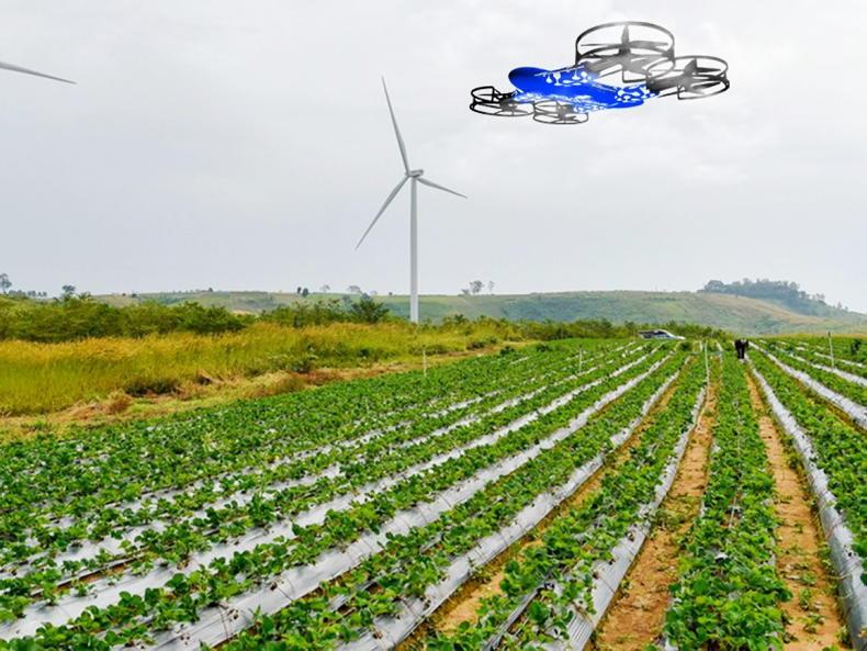
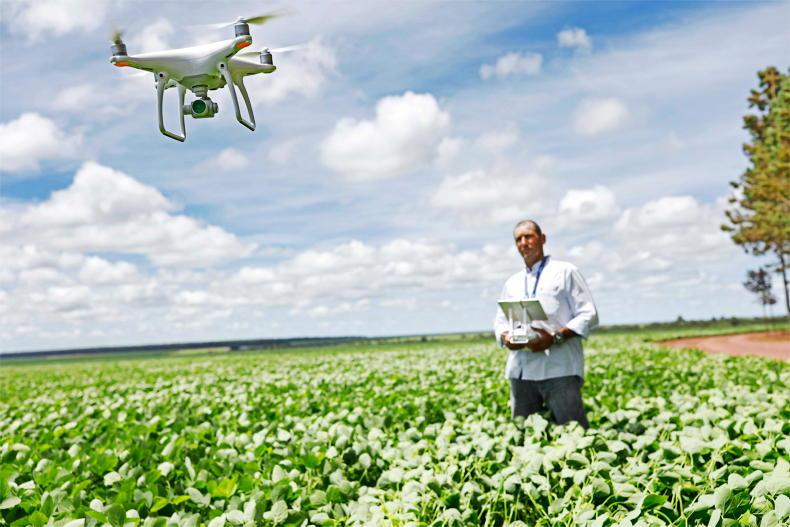
Drone technology continues to develop and is likely to play a central role in the management of many farms in the near future. Over the past decade or so, the use of drones in agriculture has increased considerably, mostly from service providers. Drones are now routinely used in farm mapping, photography and in some cases, used to assist in crop walking and assessment.
Arguably however, this is still just the tip of the iceberg and most farmers only use a drone for leisure purposes. This is likely to change over the coming decade as technology advances. As the case studies in this article show, the use of drones for practical day-to-day farm tasks is just around the corner.
However, regardless of how you use your drone, there are rules to follow. In response to queries to Irish Farmers Journal about the rules, this article will run through the dos and don’ts when it comes to drone piloting. The new EU drone regulations came into effect on 1 January 2021 so there are now many common rules which apply across the bloc.
Should I register my drone?
If your drone is over 250g in weight, or has a camera or sensor, it needs to be registered with the Irish Aviation Authority (IAA). The IAA supervises and implements the regulation in Ireland. If your drone weighs less than 250g and is classed as a toy, then you don’t have to register it.
Where do I register?
Registration can be completed with the IAA on the MySRS portal by an individual pilot or an organisation by following this link online: www.iaa.ie/general-aviation/drones.
How much does it cost?
The fee to register is €30 for a two-year operator registration certificate.
Do I have to be a minimum age to fly a drone?
Technically yes. You must be over 16 to register as a drone operator under EU law. The IAA also advises that age guidelines indicated by drone manufacturers are followed. A parent or guardian may register the drone for those under 16.
I have a model aircraft, is there a difference between that and a drone?
Model aircraft and drones are both considered small unmanned aircraft and the same rules apply to their operation.
Do I need insurance?
It’s better to have it and not need it than to need it and not have it. The IAA recommends that everybody who operates a drone has insurance.
Do I need to label my drone?
Once registered, pilots must apply their operator ID to the drones. Some new drones have electronic ID transmission and require users to upload their operator ID into the drones.
What if I lose or crash my drone?
If you lose your drone, you will need to notify the IAA on your MySRS account. Furthermore, if you are involved in an accident with your drone, you have a legal requirement to report this to the IAA.
I only fly my drone over my fields, surely the same regulations don’t apply?
It doesn’t matter where you fly it, the regulations apply everywhere in Irish airspace.
How can I tell where controlled or restricted airspace is?
The IAA publishes information on Irish airspace. Not all restricted airspace is around airports, but remember that drones may not fly within 5km of any airport.
It is the responsibility of the person flying a drone to assess the area in which they intend to fly and inspect it for aircraft activity.
The instructions on my drone say it can reach 500m in height, can I legally fly that hight?
No. The IAA says you can’t fly your drone beyond a distance of 300m or a height of 120m above ground level in uncontrolled airspace. The authority says pilots must maintain a direct line of sight with their drone during operations. The height may be limited to 15m in certain parts of controlled airspace.
Anywhere else I can’t fly?
Drones cannot be flown over national monuments and must not fly within 30m of people, crowds, vehicles, or buildings.
Do I need training?
Yes, in general, pilots operating any drone above 250g are required to have some form of training depending on the category they want to fly in. Go to www.iaa.ie/ for more information.
ProvEye

Jerome O’Connell, CEO and co-founder, Proveye.
ProvEye is a fast-growing Irish agtech start-up which uses a combination of drones, satellites and artificial intelligence to help map grass yields and quality in near-real-time.
The company says the management of grasslands currently lacks the precision available for cereal crops, with a farmer typically walking just 5% of the farm area before making management decisions.
As such, their platform will lead to higher accuracy in grassland yield mapping, which could benefit agricultural advisers, agri-input providers and farmers, the company said.
Drones will form a central role in their platform by collecting images of grass swards for analysis.
ProvEye, a UCD spinout, was founded by Dr Jerome O’Connell and Professor Nick Holden, UCD School of Biosystems and Food Engineering.
The company was recently awarded €225,000 from the European Space Agency to support the commercialisation of the management platform.
“Our technology has the potential to revolutionise grass management not only for the dairy and beef sectors, but also for industries like renewable energy production and grass-based biorefining,” Professor Holden explained.
ZenaDrone
The ZenaDrone was officially launched in Ireland earlier this year.
The Canadian technology firm ZenaTech caused a stir earlier this year when it officially launched their newest venture, ZenaDrone, in the Irish market. The ZenaDrone 1000 is a 2m by 3m unmanned aerial vehicle aircraft, which incorporates artificial intelligence and machine learning software and claims to have multiple uses across a number of sectors including agriculture and construction.
The ZenaDrone 1000 is the latest version of the drone and boasts a range of features including:
Plant disease detection using its multispectral sensor.Intelligent flight battery with flight time of up to 60 minutes.Automatic charging with a wireless charging pad and a charge time of 60 minutes.VTOL flight mode so the drone can hover steadily, take off and land during rough winds and requires less horizontal space to launch.The frame, body and mounting plates consist of robust composite carbon fibre.Ireland was chosen as the official ZenaDrone launch pad by its founder, American Dr Shaun Passley due to the size of the agricultural sector here.
The price of the ZenaDrone 1000 starts at €55,000 but this includes the price of the drone, charging pad, setup, and training, based on guidelines from the Irish Aviation Authority.
Grass covers
Research is ongoing in a Teagasc, UCD and DCU collaboration on the effectiveness of using drone technology to assess grass covers, with the findings to date showing promising results for farmers, according to the senior Teagasc research officer working on the trials, Deirdre Hennessy.
VistaMilk, the Science Foundation Ireland (SFI) dairy research centre, is funding the drone technology trials aimed at testing the accuracy of aerial grass measuring.
The trials could lead to the eventual development of “swarms” of drones being sent to cover large areas of grassland, aiding grassland management by providing farmers with more information on the grass growth and sward composition of their paddocks.
“Image-analysing and machine-learning algorithms will work with pictures captured by drones – and even satellites in the future,” she explained.
While the current research is focused on farm-level data, future developments could see grass covers assessed by a flock of drones that could allow for countywide information to be provided in real time.
“The ultimate goal is to create an app that uses a combination of physical observations, weather predictive models and automated grass imaging that will save time and money for the farmers. While we are not there quite yet, the future is just around the corner,” Hennessy said.
Additional reporting by Noel Bardon
Drone technology continues to develop and is likely to play a central role in the management of many farms in the near future. Over the past decade or so, the use of drones in agriculture has increased considerably, mostly from service providers. Drones are now routinely used in farm mapping, photography and in some cases, used to assist in crop walking and assessment.
Arguably however, this is still just the tip of the iceberg and most farmers only use a drone for leisure purposes. This is likely to change over the coming decade as technology advances. As the case studies in this article show, the use of drones for practical day-to-day farm tasks is just around the corner.
However, regardless of how you use your drone, there are rules to follow. In response to queries to Irish Farmers Journal about the rules, this article will run through the dos and don’ts when it comes to drone piloting. The new EU drone regulations came into effect on 1 January 2021 so there are now many common rules which apply across the bloc.
Should I register my drone?
If your drone is over 250g in weight, or has a camera or sensor, it needs to be registered with the Irish Aviation Authority (IAA). The IAA supervises and implements the regulation in Ireland. If your drone weighs less than 250g and is classed as a toy, then you don’t have to register it.
Where do I register?
Registration can be completed with the IAA on the MySRS portal by an individual pilot or an organisation by following this link online: www.iaa.ie/general-aviation/drones.
How much does it cost?
The fee to register is €30 for a two-year operator registration certificate.
Do I have to be a minimum age to fly a drone?
Technically yes. You must be over 16 to register as a drone operator under EU law. The IAA also advises that age guidelines indicated by drone manufacturers are followed. A parent or guardian may register the drone for those under 16.
I have a model aircraft, is there a difference between that and a drone?
Model aircraft and drones are both considered small unmanned aircraft and the same rules apply to their operation.
Do I need insurance?
It’s better to have it and not need it than to need it and not have it. The IAA recommends that everybody who operates a drone has insurance.
Do I need to label my drone?
Once registered, pilots must apply their operator ID to the drones. Some new drones have electronic ID transmission and require users to upload their operator ID into the drones.
What if I lose or crash my drone?
If you lose your drone, you will need to notify the IAA on your MySRS account. Furthermore, if you are involved in an accident with your drone, you have a legal requirement to report this to the IAA.
I only fly my drone over my fields, surely the same regulations don’t apply?
It doesn’t matter where you fly it, the regulations apply everywhere in Irish airspace.
How can I tell where controlled or restricted airspace is?
The IAA publishes information on Irish airspace. Not all restricted airspace is around airports, but remember that drones may not fly within 5km of any airport.
It is the responsibility of the person flying a drone to assess the area in which they intend to fly and inspect it for aircraft activity.
The instructions on my drone say it can reach 500m in height, can I legally fly that hight?
No. The IAA says you can’t fly your drone beyond a distance of 300m or a height of 120m above ground level in uncontrolled airspace. The authority says pilots must maintain a direct line of sight with their drone during operations. The height may be limited to 15m in certain parts of controlled airspace.
Anywhere else I can’t fly?
Drones cannot be flown over national monuments and must not fly within 30m of people, crowds, vehicles, or buildings.
Do I need training?
Yes, in general, pilots operating any drone above 250g are required to have some form of training depending on the category they want to fly in. Go to www.iaa.ie/ for more information.
ProvEye
Jerome O’Connell, CEO and co-founder, Proveye.
ProvEye is a fast-growing Irish agtech start-up which uses a combination of drones, satellites and artificial intelligence to help map grass yields and quality in near-real-time.
The company says the management of grasslands currently lacks the precision available for cereal crops, with a farmer typically walking just 5% of the farm area before making management decisions.
As such, their platform will lead to higher accuracy in grassland yield mapping, which could benefit agricultural advisers, agri-input providers and farmers, the company said.
Drones will form a central role in their platform by collecting images of grass swards for analysis.
ProvEye, a UCD spinout, was founded by Dr Jerome O’Connell and Professor Nick Holden, UCD School of Biosystems and Food Engineering.
The company was recently awarded €225,000 from the European Space Agency to support the commercialisation of the management platform.
“Our technology has the potential to revolutionise grass management not only for the dairy and beef sectors, but also for industries like renewable energy production and grass-based biorefining,” Professor Holden explained.
ZenaDrone
The ZenaDrone was officially launched in Ireland earlier this year.
The Canadian technology firm ZenaTech caused a stir earlier this year when it officially launched their newest venture, ZenaDrone, in the Irish market. The ZenaDrone 1000 is a 2m by 3m unmanned aerial vehicle aircraft, which incorporates artificial intelligence and machine learning software and claims to have multiple uses across a number of sectors including agriculture and construction.
The ZenaDrone 1000 is the latest version of the drone and boasts a range of features including:
Plant disease detection using its multispectral sensor.Intelligent flight battery with flight time of up to 60 minutes.Automatic charging with a wireless charging pad and a charge time of 60 minutes.VTOL flight mode so the drone can hover steadily, take off and land during rough winds and requires less horizontal space to launch.The frame, body and mounting plates consist of robust composite carbon fibre.Ireland was chosen as the official ZenaDrone launch pad by its founder, American Dr Shaun Passley due to the size of the agricultural sector here.
The price of the ZenaDrone 1000 starts at €55,000 but this includes the price of the drone, charging pad, setup, and training, based on guidelines from the Irish Aviation Authority.
Grass covers
Research is ongoing in a Teagasc, UCD and DCU collaboration on the effectiveness of using drone technology to assess grass covers, with the findings to date showing promising results for farmers, according to the senior Teagasc research officer working on the trials, Deirdre Hennessy.
VistaMilk, the Science Foundation Ireland (SFI) dairy research centre, is funding the drone technology trials aimed at testing the accuracy of aerial grass measuring.
The trials could lead to the eventual development of “swarms” of drones being sent to cover large areas of grassland, aiding grassland management by providing farmers with more information on the grass growth and sward composition of their paddocks.
“Image-analysing and machine-learning algorithms will work with pictures captured by drones – and even satellites in the future,” she explained.
While the current research is focused on farm-level data, future developments could see grass covers assessed by a flock of drones that could allow for countywide information to be provided in real time.
“The ultimate goal is to create an app that uses a combination of physical observations, weather predictive models and automated grass imaging that will save time and money for the farmers. While we are not there quite yet, the future is just around the corner,” Hennessy said.
Additional reporting by Noel Bardon


SHARING OPTIONS