The project team for the Galway-Athlone Cycleway will “use publicly owned land where possible” and “strive to purchase land through voluntary agreement, if at all possible”.
Five potential routes for the cycleway have been proposed for the greenway, with a preferred route expected to be chosen later this year, according to the public consultation.
“The options use State-owned lands such as flood defence embankments, forestry tracks, bog roads and Bord na Móna railways.
“In order to connect the State-owned lands, we have identified ‘consultation areas’ where we would like to talk to the landowners and explore possible routes.
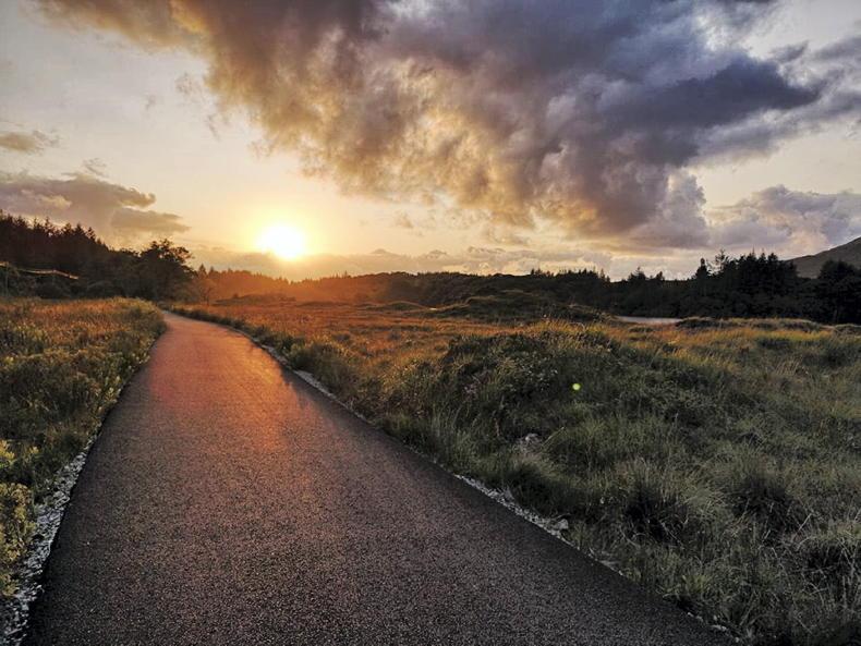
Car-free corridor
“These routes would follow existing features and farm boundaries, minimising severance,” it says.
The Galway-Athlone Cycleway will complete a 270km car-free corridor connecting Galway and Dublin and is expected to support local businesses once completed.
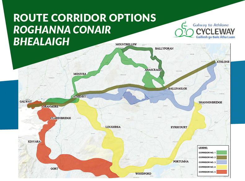
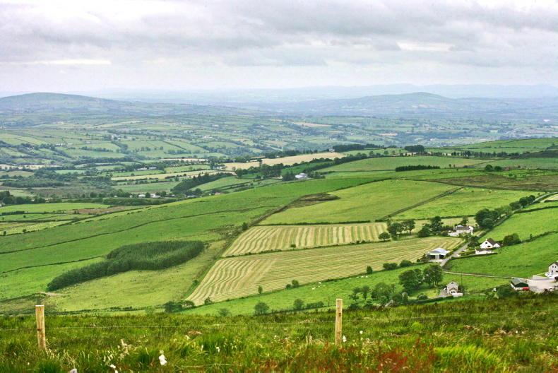
Galway Athlone Cycleway route options 2021.
Project co-ordinator Michael Kelly has said that everyone’s feedback on the route options is welcome.
“Where an option traverses privately owned land, we will engage and consult directly with the landowner over the coming months to determine the best route option.
“We have a lot of flexibility in the design of the cycleway and are confident that it will be possible to use farm boundaries to minimise impacts.
“We are committed to working with landowners to deliver a first-class cycleway for the Galway and Roscommon region,” Kelly said.
Agronomist to advise farmers
A code of best practice for national and regional greenway projects is being prepared with several farming groups, which will provide information on the acquisition of private land for the greenway.
“We aim to route the cycleway through publicly owned lands and avoid working farms, wherever practicable. However, it will be necessary to build some of the cycleway on land that is now privately owned.
“During the route corridor option selection stage, an independent agronomist will be available to advise farmers on the project and process.
“Once a route corridor is selected, each farmer within the corridor may engage their own agronomist to advise them during the design of the cycleway. This agronomist will be paid for by the project promoters."
The project team will work with the farmer and agronomist to pick the “least disruptive route possible, likely along the farm boundary”.
“The goodwill and co-operation of the farming community is important to make the cycleway a success. Real and open engagement with the landowners and community will be central to everything we do.”
Preferred route
The second phase of public consultation on the cycleway is now under way and will continue until 1 March.
The project team expects to recommend a preferred route corridor later this year.
The identification of a preferred route corridor will be informed by the feedback received during this consultation and engineering and environmental assessments.
This is the second of four periods of public consultation which will be undertaken before a planning application is made.
The project team for the Galway-Athlone Cycleway will “use publicly owned land where possible” and “strive to purchase land through voluntary agreement, if at all possible”.
Five potential routes for the cycleway have been proposed for the greenway, with a preferred route expected to be chosen later this year, according to the public consultation.
“The options use State-owned lands such as flood defence embankments, forestry tracks, bog roads and Bord na Móna railways.
“In order to connect the State-owned lands, we have identified ‘consultation areas’ where we would like to talk to the landowners and explore possible routes.
Car-free corridor
“These routes would follow existing features and farm boundaries, minimising severance,” it says.
The Galway-Athlone Cycleway will complete a 270km car-free corridor connecting Galway and Dublin and is expected to support local businesses once completed.
Galway Athlone Cycleway route options 2021.
Project co-ordinator Michael Kelly has said that everyone’s feedback on the route options is welcome.
“Where an option traverses privately owned land, we will engage and consult directly with the landowner over the coming months to determine the best route option.
“We have a lot of flexibility in the design of the cycleway and are confident that it will be possible to use farm boundaries to minimise impacts.
“We are committed to working with landowners to deliver a first-class cycleway for the Galway and Roscommon region,” Kelly said.
Agronomist to advise farmers
A code of best practice for national and regional greenway projects is being prepared with several farming groups, which will provide information on the acquisition of private land for the greenway.
“We aim to route the cycleway through publicly owned lands and avoid working farms, wherever practicable. However, it will be necessary to build some of the cycleway on land that is now privately owned.
“During the route corridor option selection stage, an independent agronomist will be available to advise farmers on the project and process.
“Once a route corridor is selected, each farmer within the corridor may engage their own agronomist to advise them during the design of the cycleway. This agronomist will be paid for by the project promoters."
The project team will work with the farmer and agronomist to pick the “least disruptive route possible, likely along the farm boundary”.
“The goodwill and co-operation of the farming community is important to make the cycleway a success. Real and open engagement with the landowners and community will be central to everything we do.”
Preferred route
The second phase of public consultation on the cycleway is now under way and will continue until 1 March.
The project team expects to recommend a preferred route corridor later this year.
The identification of a preferred route corridor will be informed by the feedback received during this consultation and engineering and environmental assessments.
This is the second of four periods of public consultation which will be undertaken before a planning application is made.


SHARING OPTIONS