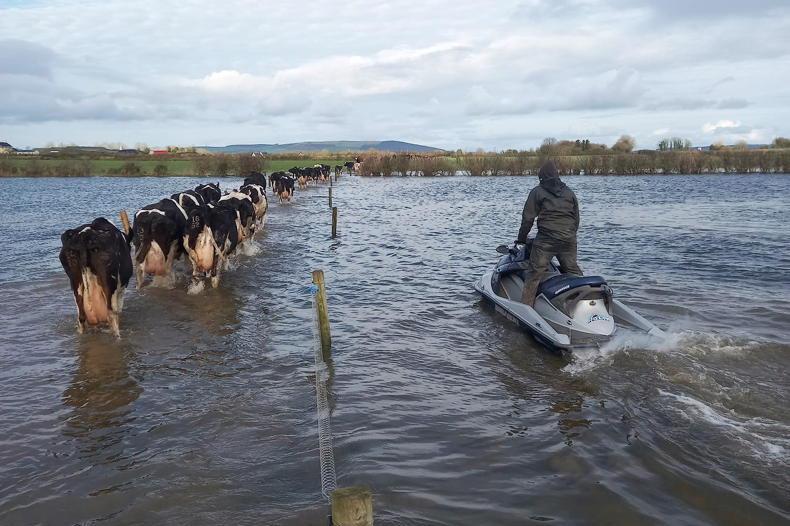
A map has been produced for the Office of Public Works showing the location of the 16 underwater obstacles, termed pinch points, which will be cleared from the River Shannon next year.
They lie along a 42km stretch of the Shannon Callows.
Four of the locations lie between Athlone and Clonmacnoise. They are Wren’s Island, South Long Island, Calf Island Upper and Lower and Tullymore.
These trees are obstructing water flow
The next three, lying between Clonmacnoise and Shannonbridge, are Devenish Upper, Devenish Lower and Shannonbridge.
The next four, between Shannonbridge and Shannon Harbour, are Bishop’s Island Upper, Bishop’s Island Lower, Derryholmes and Leahinch Island.
There is one pinch point in the stretch between Shannon Harbour and Banagher, at South Banagher Bridge.
The final four pinch points lie between Banagher and Victoria Lock. They are Councillor’s Ford, Mucknish Island, Upstream Meelick Quay and Meelick Canal.
Lower river bed
Removing these underwater obstacles will allow the river level to be lowered by a target 13in in summer months, reducing flooding risk on farmland, while still ensuring the river is navigable for tourist and leisure cruisers.
An engineering consultant has been appointed to draw up a plan for removal of the pinch points, which is likely to be delivered in the second half of 2019, allowing work to begin.
Minister of State Kevin Boxer Moran last week announced that removal of fallen trees from the river at Madden’s Island would recommence next week and continue until February.
“These trees are obstructing water flow. Removing them will allow water get through the system more quickly," he said.
Read more
Farmers to benefit from Shannon dredging


SHARING OPTIONS