

Storm Gareth is to make landfall over western coasts on Tuesday afternoon (12 March), bringing westerly winds up to 75km/h and damaging gusts up to 130km/h.
Met Éireann has issued an orange warning, placing counties Donegal, Leitrim, Mayo and Sligo on high alert from Tuesday afternoon until 9am on Wednesday.
There is also a status yellow rainfall warning for all of Connacht and Atlantic counties Donegal, Clare, Cork, Kerry and Limerick.
It is anticipated there will be rainfall accumulations of 25mm between 6pm this evening (Monday) and 6am on Tuesday morning.
All-island warning
The entire country has been issued with a 24-hour yellow warning for high winds between 12pm on Tuesday and 12pm Wednesday.
It is expected that westerly winds will reach speeds of 50km/h to 65km/h and will be accompanied by gusts reaching up to 110km/h.
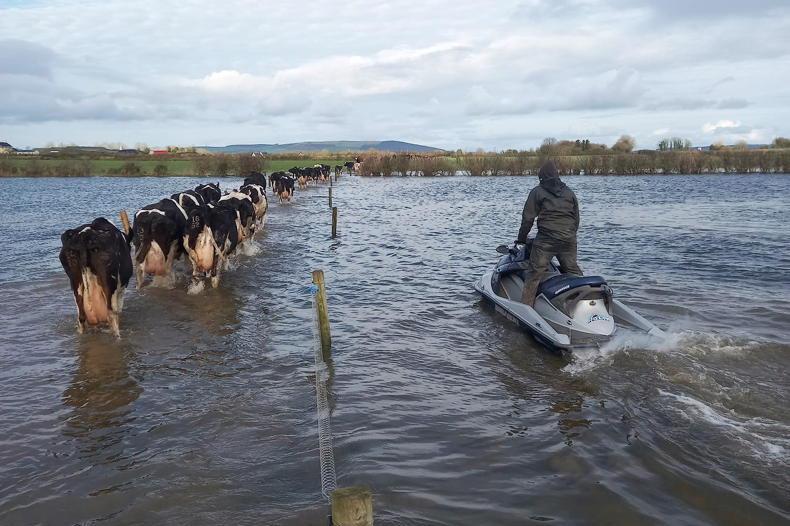
There is a risk of coastal flooding due to high seas along Atlantic coasts.
Atlantic regime
According to Met Éireann meteorologist Liz Walsh, a highly mobile Atlantic regime has been responsible for the sustained period of unsettled, often very windy and at times wintry weather over the weekend and into the coming week.
A strong jet stream has helped to push the vigorous and disruptive Atlantic weather systems over Ireland.


SHARING OPTIONS