


The Common Agricultural Policy has entered the space age. New rules adopted by the European Commission give member states the option to completely replace physical checks on farms with a system of automated checks. These will be based on analysis of earth observation data. The move is part of the Commission's ongoing move to simplify the Common Agricultural Policy.
“This new satellite technology will significantly reduce the number of field inspections, removing the climate of fear, which causes significant stress for farmers,” European Commissioner for Agriculture Phil Hogan said.
The new rules came into force on 22 May 2018. Data from the EU’s Copernicus Sentinel satellites and other earth observation data can now be used as evidence when checking farmers’ fulfilment of requirements under the CAP for area-based payments (either direct payments to farmers or rural development support payments). This also applies to cross-compliance requirements, such as stubble burning.
Other new forms of evidence such as geo-tagged photos, information from drones and relevant supporting documentation from farmers, such as seed labels, will also be acceptable for the first time. The aim is to decrease the number of on-farm checks.
“Visits to the field will only be necessary when the digital evidence is not sufficient to verify compliance,” the Commission says.
Commissioner Hogan said: "It will also benefit public administrations, by reducing the costs of administering controls and checks. It is thus a win-win for farmers and administrators.”
Several member states have already indicated their intention to immediately start using new technologies such a geo-tagged photos.
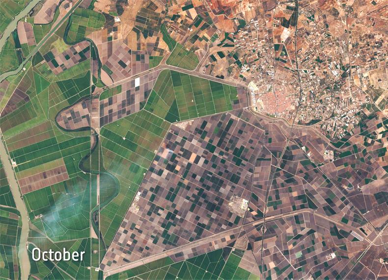
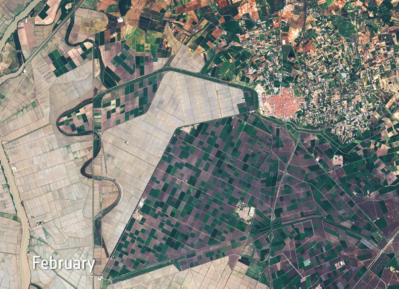
Changing landscape in Spain’s Brazo de Este natural park and around the city of Los Palacios y Villafranca. \ Copernicus Sentinel data (2016), processed by ESA
Earth observation data
Data from the Copernicus Sentinel satellites and other technology such as geo-tagged photos will be processed automatically using computer algorithms that can determine things like land use or land cover.
This information is then compared with existing information in the Land Parcel Identification System (LPIS), and cross-referenced with each area aid application to assess whether the payment can be made.
If the system cannot determine whether claims are accurate, additional evidence (including geo-tagged photos or other relevant documentation submitted by the farmer or data from drones, for example) may be used to support the claim. If this too proves inconclusive, physical inspections in the field may have to be carried out.
Options
Countries will be free to choose whether to apply the new monitoring approach. They will have flexibility over whether to apply it to specific aid schemes, such as the basic payment scheme, or to rural development support measures, or to combinations of the two.


SHARING OPTIONS