John Deere partners with precision ag company Solorrow
John Deere has recently partnered up with German agri-tech start-up company Solorrow for seamless communication between its variable rate application maps and the John Deere Operations Center.
Prescription maps can be created on the Solorrow app and transferred to the John Deere Operations Center.
ADVERTISEMENT
Solorrow, a German agri-tech company has launched an app for farmers to create prescription maps for precision farming based on satellite images.
The start-up company has recently entered a partnership with John Deere allowing its variable rate application maps to be shared with the John Deere Operations Center.
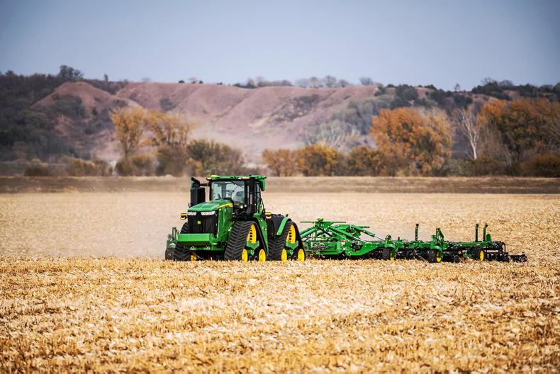
Farmers can now create variable rate application maps for fertilising and other field operations then share them wirelessly with John Deere’s Operation Center.
ADVERTISEMENT
How it works
Solorrow offers a solution which allows users to quickly identify fields and their boundaries in a map view on their tablet or smartphone.
The selected areas can be then divided into different soil zones that act as the basis for fertiliser and application maps. Once these maps are sent to the operations centre, they can then be wirelessly sent to the appropriate tractor or machine. The in-cab display receives the data and provides the Isobus controlled fertiliser spreader or sprayer the site specific application rate based on its current position in the field.
John Deere said that this interaction with the Solorrow app not only has agricultural benefits, but also demonstrates that the smooth exchange of data between different manufacturers’ software solutions is possible and practical.
Register for free to read this story and our free stories.
This content is available to digital subscribers and loyalty code users only. Sign in to your account, use the code or subscribe to get unlimited access.
The reader loyalty code gives you full access to the site from when you enter it until the following Wednesday at 9pm. Find your unique code on the back page of Irish Country Living every week.
CODE ACCEPTED
You have full access to the site until next Wednesday at 9pm.
CODE NOT VALID
Please try again or contact support.
Solorrow, a German agri-tech company has launched an app for farmers to create prescription maps for precision farming based on satellite images.
The start-up company has recently entered a partnership with John Deere allowing its variable rate application maps to be shared with the John Deere Operations Center.
Farmers can now create variable rate application maps for fertilising and other field operations then share them wirelessly with John Deere’s Operation Center.
How it works
Solorrow offers a solution which allows users to quickly identify fields and their boundaries in a map view on their tablet or smartphone.
The selected areas can be then divided into different soil zones that act as the basis for fertiliser and application maps. Once these maps are sent to the operations centre, they can then be wirelessly sent to the appropriate tractor or machine. The in-cab display receives the data and provides the Isobus controlled fertiliser spreader or sprayer the site specific application rate based on its current position in the field.
John Deere said that this interaction with the Solorrow app not only has agricultural benefits, but also demonstrates that the smooth exchange of data between different manufacturers’ software solutions is possible and practical.
If you would like to speak to a member of our team, please call us on 01-4199525.
Link sent to your email address
We have sent an email to your address. Please click on the link in this email to reset your password. If you can't find it in your inbox, please check your spam folder. If you can't find the email, please call us on 01-4199525.
ENTER YOUR LOYALTY CODE:
The reader loyalty code gives you full access to the site from when you enter it until the following Wednesday at 9pm. Find your unique code on the back page of Irish Country Living every week.


SHARING OPTIONS