Every parcel of land submitted as part of a farmer’s Basic Income Support for Sustainability (BISS), which replaces the Basic Payment Scheme, and Areas of Natural Constraint (ANC) application will be subject to a full inspection from 2023 onwards.
The new protocol known as the area monitoring system (AMS) is mandatory for each member state to implement and will replace the current protocol where at least 5% of applications to these schemes are subject to on-the-spot checks.
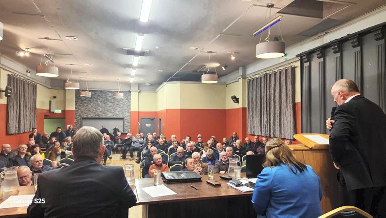
At a recent Farm Advisory System (FAS) information session held by the Department of Agriculture, principal head of direct payments division - beef and eco schemes David Buckley said that there are numerous changes to farm schemes coming into effect in 2023 and stated that the introduction of AMS is one of the biggest changes that will impact advisers, the Department of Agriculture and farmers.
An explanation of the AMS was delivered during the information session by Eoin Dooley from the Department of Agriculture.
Transitional arrangements
He outlined that the introduction of AMS for BISS and ANC in 2023 is part of transitional arrangements with the mandatory system set to be implemented across all area-based schemes in 2024.
The ‘checks by monitoring’ system, which has been used for schemes such as the Protein Aid Scheme and the Straw Incorporation Scheme, will continue in 2023 before being replaced in 2024 by AMS.
The 5% on-the-spot inspection protocol, which is currently in place for the Basic Payment Scheme and the ANC, will cease to exist for these schemes in 2023 and be replaced by 100% area monitoring.
The monitoring of land areas will be carried out via satellites, with the working of these satellites explained later.
Two approaches
The AMS has two main approaches. The first part is evaluating if the delineated or defined areas claimed are suitable for AMS analysis. This is essentially evaluating if the area within each LPIS parcel matches what is claimed.
There are three main component checks here. The first is to check if there is any change to the category or land use listed – for example, a change from arable, grassland or a permanent crop.
If the crop is listed as permanent grassland, then the AMS will identify if all lands within the LPIS are such.
The next component is a check for ineligible features. This will typically include a check for ineligible structures such as farmyards, farmyard extensions (concrete areas, etc) and houses.
The third component is the presence of ineligible land use. The most common ineligible land use is areas of scrub.
Areas of scrub will be deemed eligible for payment under certain circumstances, but they will still need to be accounted for
As outlined in recent weeks, under the CAP Strategic Plan 2023-2027, areas of scrub will be deemed eligible for payment under certain circumstances, but they will still need to be accounted for and designated as such.
The finding of any of these three components may trigger a warning. The warning alert will be via the agfood.ie portal and also by text for those registered to receive SMS correspondence from the Department.
The text will notify an applicant that there is an issue and advise them to login to agfood.ie to check. Depending on the warning, farmers may be required to take action to address it.
Eligibility conditions
The second part of the AMS will track and assess AMS monitorable eligibility conditions. This will, in most cases, assess if there is a farming activity taking place.
Examples of farming activity listed include identifying practices such as grazing by livestock, the mowing of grass and harvesting/sowing of crops.
Where there is doubt about certain activities, these areas may be monitored for longer or farmers may be required to act and confirm an activity.
As detailed below, the first results from the AMS will become available in mid-June. These results relate to a hard feature check completed on every parcel that is claimed.
The Department advises that if a parcel contains, for example, a house site, house, farmyard, or a hard sealed surface, then the applicant will receive a notification that there is an ineligible structure in a parcel and be asked to go back into the system and exclude it from the application.
The first full set of AMS results on every parcel submitted under BISS and ANC will be made available to every farmer on 1 August 2023 via agfood.ie. The results will take the form of a traffic light system and farmers have until 1 September to respond to any warnings raised.
A green score confirms the findings of the AMS corresponds to what an applicant has claimed and that a farming activity is taking place.
A red score means the findings do not correspond to what is claimed. As mentioned above, this could be the presence of an ineligible structure, a different crop to what is claimed, the presence of two crops when only one is claimed, or an incorrectly marked subdivision between crops.
An orange score is an inconclusive finding – it means that enough information has not been collected from the satellites at that particular time of year and therefore further monitoring of that parcel will be required.
Use of AgriSnap
The Department of Agriculture’s unique photo application, AgriSnap, will be used with greater frequency from 2023 onwards, with geotagged photos deemed at least equivalent in value to sentinel satellites when it comes to capturing information.
This may be used in certain circumstances to confirm or reject the Department’s findings, such as confirming extensive grazing, mowing of grass etc.
Ensuring compliance
Eoin advises that there are four criteria that farmers and advisers can follow to ensure compliance. These are listed as follows and it is important that farmers study maps and claimed areas when the 2023 Basic Income Support for Sustainability opens in early to mid-February;
Claim the correct area.Claim the correct parcel use.Deduct ineligible features.Respond promptly to correspondence.As briefly touched on above, the AMS will utilise information collected from satellites. The Department explains that Copernicus Sentinel Satellites will be used. These satellites are from the EU space programme, described as the largest space data provider in the world.
There are seven missions of satellites and the AMS in every member state will utilise Sentinel 1 and 2. Sentinel 1 consists of two polar-orbiting radar satellites launched in 2014 and 2016. These satellites send out a microwave signal to the earth and measure the signal that bounces back.
The information collected allows the Department to understand what’s happening in a particular area of land, whether that be ploughing, a crop being harvested, grass after being cut etc.
The Irish AMS will be reliant on Sentinel 1 as it is not impaired by the presence of physical clouds.

The Sentinel 1 satellite is not impared by cloud cover and can capture information every five days.
The working mechanism of Sentinel 2 is described as capturing an image (measures the visible and infrared light).
There are also two polar-orbiting satellites launched in 2015 and 2017. The pixel or resolution of the images captured is coarse, but this is compensated for by the high frequency at which images are captured.

Sentinel 2 satellites will also provide the imagery used to monitor Irish farms and confirm compliance with schemes from 2023 onwards. \ ESA-ATG medialab
Sentinel 1 and Sentinel 2 collect information every five days.
However, the quality of information obtained from Sentinel 2 is limited by cloud cover, so while information is collected every five days, at times this information is not utilisable.
Every parcel of land submitted as part of a farmer’s Basic Income Support for Sustainability (BISS), which replaces the Basic Payment Scheme, and Areas of Natural Constraint (ANC) application will be subject to a full inspection from 2023 onwards.
The new protocol known as the area monitoring system (AMS) is mandatory for each member state to implement and will replace the current protocol where at least 5% of applications to these schemes are subject to on-the-spot checks.
At a recent Farm Advisory System (FAS) information session held by the Department of Agriculture, principal head of direct payments division - beef and eco schemes David Buckley said that there are numerous changes to farm schemes coming into effect in 2023 and stated that the introduction of AMS is one of the biggest changes that will impact advisers, the Department of Agriculture and farmers.
An explanation of the AMS was delivered during the information session by Eoin Dooley from the Department of Agriculture.
Transitional arrangements
He outlined that the introduction of AMS for BISS and ANC in 2023 is part of transitional arrangements with the mandatory system set to be implemented across all area-based schemes in 2024.
The ‘checks by monitoring’ system, which has been used for schemes such as the Protein Aid Scheme and the Straw Incorporation Scheme, will continue in 2023 before being replaced in 2024 by AMS.
The 5% on-the-spot inspection protocol, which is currently in place for the Basic Payment Scheme and the ANC, will cease to exist for these schemes in 2023 and be replaced by 100% area monitoring.
The monitoring of land areas will be carried out via satellites, with the working of these satellites explained later.
Two approaches
The AMS has two main approaches. The first part is evaluating if the delineated or defined areas claimed are suitable for AMS analysis. This is essentially evaluating if the area within each LPIS parcel matches what is claimed.
There are three main component checks here. The first is to check if there is any change to the category or land use listed – for example, a change from arable, grassland or a permanent crop.
If the crop is listed as permanent grassland, then the AMS will identify if all lands within the LPIS are such.
The next component is a check for ineligible features. This will typically include a check for ineligible structures such as farmyards, farmyard extensions (concrete areas, etc) and houses.
The third component is the presence of ineligible land use. The most common ineligible land use is areas of scrub.
Areas of scrub will be deemed eligible for payment under certain circumstances, but they will still need to be accounted for
As outlined in recent weeks, under the CAP Strategic Plan 2023-2027, areas of scrub will be deemed eligible for payment under certain circumstances, but they will still need to be accounted for and designated as such.
The finding of any of these three components may trigger a warning. The warning alert will be via the agfood.ie portal and also by text for those registered to receive SMS correspondence from the Department.
The text will notify an applicant that there is an issue and advise them to login to agfood.ie to check. Depending on the warning, farmers may be required to take action to address it.
Eligibility conditions
The second part of the AMS will track and assess AMS monitorable eligibility conditions. This will, in most cases, assess if there is a farming activity taking place.
Examples of farming activity listed include identifying practices such as grazing by livestock, the mowing of grass and harvesting/sowing of crops.
Where there is doubt about certain activities, these areas may be monitored for longer or farmers may be required to act and confirm an activity.
As detailed below, the first results from the AMS will become available in mid-June. These results relate to a hard feature check completed on every parcel that is claimed.
The Department advises that if a parcel contains, for example, a house site, house, farmyard, or a hard sealed surface, then the applicant will receive a notification that there is an ineligible structure in a parcel and be asked to go back into the system and exclude it from the application.
The first full set of AMS results on every parcel submitted under BISS and ANC will be made available to every farmer on 1 August 2023 via agfood.ie. The results will take the form of a traffic light system and farmers have until 1 September to respond to any warnings raised.
A green score confirms the findings of the AMS corresponds to what an applicant has claimed and that a farming activity is taking place.
A red score means the findings do not correspond to what is claimed. As mentioned above, this could be the presence of an ineligible structure, a different crop to what is claimed, the presence of two crops when only one is claimed, or an incorrectly marked subdivision between crops.
An orange score is an inconclusive finding – it means that enough information has not been collected from the satellites at that particular time of year and therefore further monitoring of that parcel will be required.
Use of AgriSnap
The Department of Agriculture’s unique photo application, AgriSnap, will be used with greater frequency from 2023 onwards, with geotagged photos deemed at least equivalent in value to sentinel satellites when it comes to capturing information.
This may be used in certain circumstances to confirm or reject the Department’s findings, such as confirming extensive grazing, mowing of grass etc.
Ensuring compliance
Eoin advises that there are four criteria that farmers and advisers can follow to ensure compliance. These are listed as follows and it is important that farmers study maps and claimed areas when the 2023 Basic Income Support for Sustainability opens in early to mid-February;
Claim the correct area.Claim the correct parcel use.Deduct ineligible features.Respond promptly to correspondence.As briefly touched on above, the AMS will utilise information collected from satellites. The Department explains that Copernicus Sentinel Satellites will be used. These satellites are from the EU space programme, described as the largest space data provider in the world.
There are seven missions of satellites and the AMS in every member state will utilise Sentinel 1 and 2. Sentinel 1 consists of two polar-orbiting radar satellites launched in 2014 and 2016. These satellites send out a microwave signal to the earth and measure the signal that bounces back.
The information collected allows the Department to understand what’s happening in a particular area of land, whether that be ploughing, a crop being harvested, grass after being cut etc.
The Irish AMS will be reliant on Sentinel 1 as it is not impaired by the presence of physical clouds.
The Sentinel 1 satellite is not impared by cloud cover and can capture information every five days.
The working mechanism of Sentinel 2 is described as capturing an image (measures the visible and infrared light).
There are also two polar-orbiting satellites launched in 2015 and 2017. The pixel or resolution of the images captured is coarse, but this is compensated for by the high frequency at which images are captured.
Sentinel 2 satellites will also provide the imagery used to monitor Irish farms and confirm compliance with schemes from 2023 onwards. \ ESA-ATG medialab
Sentinel 1 and Sentinel 2 collect information every five days.
However, the quality of information obtained from Sentinel 2 is limited by cloud cover, so while information is collected every five days, at times this information is not utilisable.


SHARING OPTIONS