

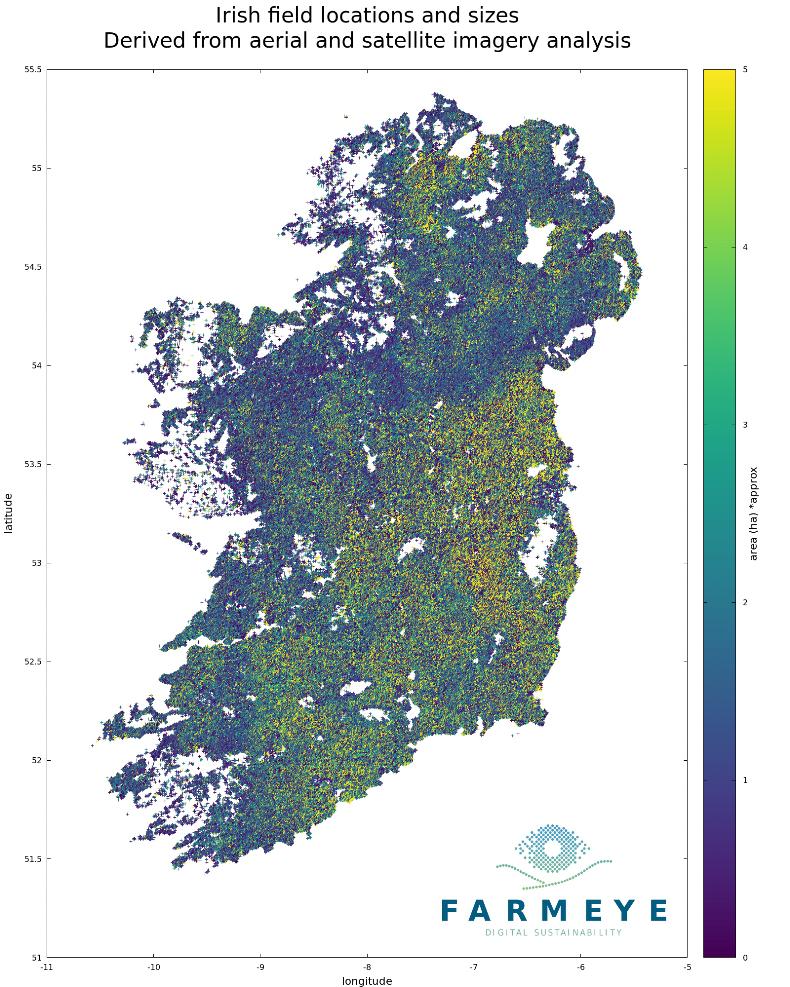
Roscommon-based soil management company Farmeye has published a map detailing the area of every field on the island of Ireland for the first time as part of its ongoing ‘Deep Learning’ project.
The team has found a wide range in the average field size across the country, with the average field size in parts of the west standing at three acres, and greater than 12ac in Leinster.
With over 1.5m fields in Ireland, the national average was found to be about seven acres, with very large tracts of land and small paddocks excluded from the survey.
New software
Farmeye collects 24,000 data points on every field on the island each year using the Sentinel-1 and Sentinel-2 satellites as part of the European Commission’s Copernicus Programme.
Managing director Eoghan Finneran told the Irish Farmers Journal: “Our map is highly accurate and has accounted for each individual field boundary.
“The Department’s Land Parcel Identification System (LPIS) is similar but bunches multiple fields into the one parcel and does not provide the exact boundaries for each individual field.”
This is not a spying or a compliance tool
Farmeye has said it is in the early stages of developing software with the ability to conduct soil analysis without the need for physical sampling. This method would combined aerial and satellite imagery with previous soil samples on file from around the island.
“This is not a spying or a compliance tool, we are farmers ourselves and understand that making life better for the farmer benefits everyone in the food chain, from processors to consumers,” Finneran emphasised.


SHARING OPTIONS