Monday
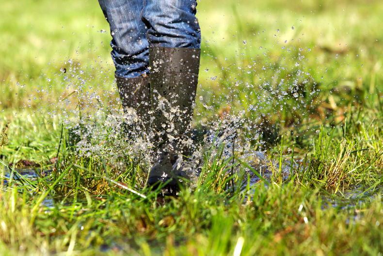
The week will start out wet and blustery according to Met Éireann. Persistent rain will cross the country, turning heavy at times, especially in the west and north.
There will be a risk of spot flooding and a heightened risk of flash flooding in mountainous areas. Highest temperatures will range from 12°C to 14°C.
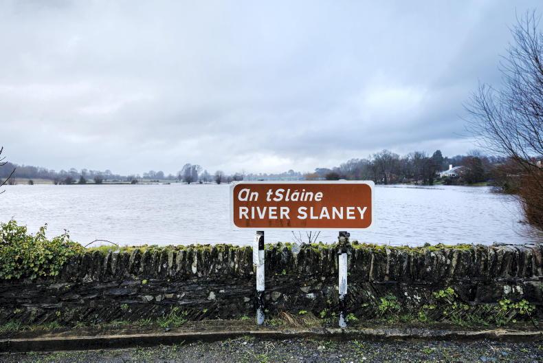
Widespread persistent rain is forecast for early on Monday night, bringing further risk of river and surface flooding. Rain will continue across the northern half of the country while in the south it will turn drier.
Lowest temperatures will range from 9°C to 12°C in strong winds along southern and eastern areas.
Tuesday
Strong southerly winds are forecast to move over Ireland on Tuesday. Heavy and persistent rain is expected to clear in northern areas during the morning.
Further outbreaks of heavy rain are expected to move northeastwards across the country later in the day. Top temperatures will range from 13°C to 15°C.
By night, Tuesday will bring drier conditions with lowest temperatures of 7°C to 10°C. Winds will ease in most areas while strong northerly winds will develop along western and northern coasts.
Wednesday
Wednesday will be a cooler day with moderate to fresh northerly winds. There will be highs of 10°C to 13°C in cloudy conditions with some scattered showers at first but brightening up to good spells of sunshine.
By night, Wednesday will be cool, dry and clear, with frost likely in many areas. Lowest temperatures will range from 0°C to 4°C.
Thursday
There willl be a bright but chilly start to Thursday morning, remaining mostly dry throughout the day with good spells of sunshine. It will be a cool day, with highest temperatures of 9°C to 11°C.
Further outlook
Current forecasts indicate unsettled conditions on Friday and the weekend with further spells of wet and occasionally windy weather.
Rain
Most areas had less than 25% of normal rainfall last week. Weather conditions will become more unsettled on Monday, with rainfall totals for the coming week expected to be higher than average in all areas.
Flooding in some areas is likely with up to three times the average weekly rainfall possible. Monday is likely to be the wettest day, with 30mm to 50mm possible in western and southern counties, with local flooding.
Temperatures
Mean air temperatures were lower than usual over the past week, varying between around 9°C and 11°C degrees. Mean air temperatures for the coming week will be around average, ranging from 10°C in the north to 13°C in the south.
Soil temperatures ranged between 9.5°C and 12°C last week, which is normal, with temperatures remaining steady this week.
Drying conditions
Drying conditions will generally be poor during the coming week. Thursday will be the best day for drying, with perhaps some drier spells late Friday and early Saturday.
Field Conditions
Moderately drained soils are close to being saturated, with some poorly drained soils already waterlogged. All soils will be saturated by Tuesday, even well-drained soils, as 25mm to 50mm of rain falls across the country.
Soils may get some respite during midweek, while more heavy rain is expected next weekend.
Read more
Clipping cattle at housing time
Sheep management: liver fluke, clean livestock policy and scannig early lambers
Monday
The week will start out wet and blustery according to Met Éireann. Persistent rain will cross the country, turning heavy at times, especially in the west and north.
There will be a risk of spot flooding and a heightened risk of flash flooding in mountainous areas. Highest temperatures will range from 12°C to 14°C.
Widespread persistent rain is forecast for early on Monday night, bringing further risk of river and surface flooding. Rain will continue across the northern half of the country while in the south it will turn drier.
Lowest temperatures will range from 9°C to 12°C in strong winds along southern and eastern areas.
Tuesday
Strong southerly winds are forecast to move over Ireland on Tuesday. Heavy and persistent rain is expected to clear in northern areas during the morning.
Further outbreaks of heavy rain are expected to move northeastwards across the country later in the day. Top temperatures will range from 13°C to 15°C.
By night, Tuesday will bring drier conditions with lowest temperatures of 7°C to 10°C. Winds will ease in most areas while strong northerly winds will develop along western and northern coasts.
Wednesday
Wednesday will be a cooler day with moderate to fresh northerly winds. There will be highs of 10°C to 13°C in cloudy conditions with some scattered showers at first but brightening up to good spells of sunshine.
By night, Wednesday will be cool, dry and clear, with frost likely in many areas. Lowest temperatures will range from 0°C to 4°C.
Thursday
There willl be a bright but chilly start to Thursday morning, remaining mostly dry throughout the day with good spells of sunshine. It will be a cool day, with highest temperatures of 9°C to 11°C.
Further outlook
Current forecasts indicate unsettled conditions on Friday and the weekend with further spells of wet and occasionally windy weather.
Rain
Most areas had less than 25% of normal rainfall last week. Weather conditions will become more unsettled on Monday, with rainfall totals for the coming week expected to be higher than average in all areas.
Flooding in some areas is likely with up to three times the average weekly rainfall possible. Monday is likely to be the wettest day, with 30mm to 50mm possible in western and southern counties, with local flooding.
Temperatures
Mean air temperatures were lower than usual over the past week, varying between around 9°C and 11°C degrees. Mean air temperatures for the coming week will be around average, ranging from 10°C in the north to 13°C in the south.
Soil temperatures ranged between 9.5°C and 12°C last week, which is normal, with temperatures remaining steady this week.
Drying conditions
Drying conditions will generally be poor during the coming week. Thursday will be the best day for drying, with perhaps some drier spells late Friday and early Saturday.
Field Conditions
Moderately drained soils are close to being saturated, with some poorly drained soils already waterlogged. All soils will be saturated by Tuesday, even well-drained soils, as 25mm to 50mm of rain falls across the country.
Soils may get some respite during midweek, while more heavy rain is expected next weekend.
Read more
Clipping cattle at housing time
Sheep management: liver fluke, clean livestock policy and scannig early lambers


SHARING OPTIONS