

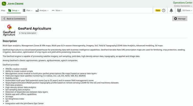
GeoPard, a German ag-tech company, has announced its integration with the MyJohnDeere Operations Centre.
John Deere ops centre is a digital platform, where users can manage the logistics and services of their machine fleets and equipment.
The integration means that MyJohnDeere customers can now seamlessly upload their data into the GeoPard system, where the company claims it can do an advanced data analysis, compare information to other data sets and create detailed variable rate application (VRA) maps for seeding, fertilising and spraying.
These maps can then be wirelessly sent back to the MyJohnDeere Operations Centre and subsequently to fleets and machinery via a cloud-to-cloud connection, with no need for a USB stick.
Synchronisation
GeoPard said that it provides automated synchronisation of crop monitoring, detailed topography analytics, machinery and soil scanner data for MyJohnDeere clients.
From the John Deere Operations Centre, field boundaries, seeding (as-planted) data, as-applied fertiliser maps, as-applied crop protection, tillage data and yield data can all be imported to GeoPard and cross-analysed.
The German firm says the integration has simplified the data analysis process for multiple parties and stakeholders by providing them with a smooth-running analytical engine to gain new insights about relevant land parcels and logistics.


SHARING OPTIONS