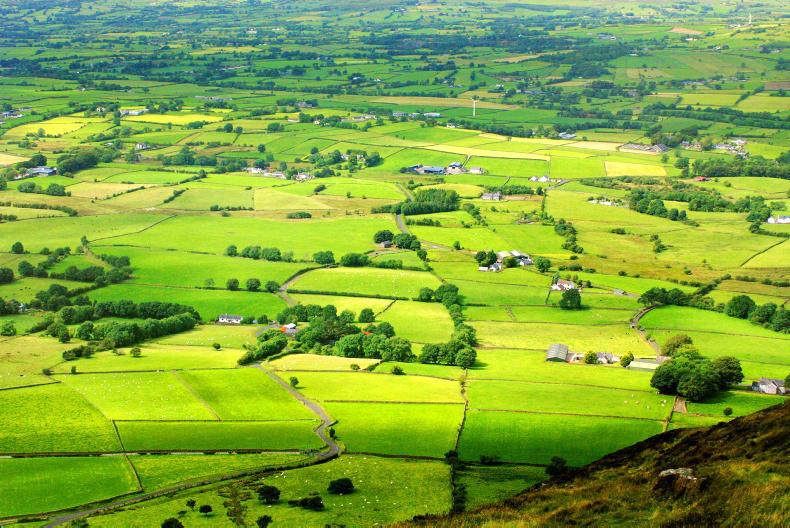
A new mapping system for farm systems is being rolled out by the Department of Agriculture.
Farmers in Co Louth will be the first to find out if their eligible area will be cut or increased as a result.
“If there is a reduction in your eligible area as a result of the new LPIS, the Department will reduce the claimed area to match the new eligible area, avoiding an overclaim,” a letter from the Department to farmers affected reads.
At a meeting between the Department and farm organisations on Wednesday, farmers were assured that the re-mapping of land parcels will not delay the rollout of BPS payments to those affected.
Completion
The new version of the Land Parcel Identification System (LPIS) is expected to be completed for the whole country by 2021. It is based on the most up-to-date Ordnance Survey Ireland maps, which were launched in 2015.
Following the meeting in Portlaoise, IFA deputy president Richard Kennedy said the review, which is being communicated to farmers in Co Louth, will be soon followed by counties Meath and Monaghan.
He urged farmers to examine their maps and if they have concerns to attend the Department information meetings, which will be held in the Louth area in early March.
Assurances
The IFA said it received assurances that any change to the area of a GLAS measure will not affect the plan until the five-year contract period is up.
All land parcels moving to the new LPIS have been renumbered as part of the changeover to the new system.
Land parcels with administrative boundaries that are not associated with a real-world feature on the ground, such as a hedgerow or a road, will be merged into a single parcel from 2019. And land parcels with rivers or roads cutting across them will be split into separate parcels.
Read more
New BPS mapping system to be rolled out


SHARING OPTIONS