Friday
Rain will clear early on Friday with most areas holding dry, Met Éireann has forecasted. There will be sunny spells and scattered showers, mainly in the northwest. Highest temperatures will range from 9°C to 13°C.
By night, Friday will be wet and windy. Heaviest rain will continue across Atlantic counties overnight with some possible flooding. It will be coolest early on with lowest temperatures of 5°C to 9°C.
Saturday
Saturday will begin very wet and windy with rain soon clearing to sunshine and passing heavy showers by early afternoon. There will be a risk of hail and isolated thunderstorms later with highest temperatures of 11°C to 14°C.
It will be ool and windy on Saturday night with mainly clear spells. There will be some heavy and prolonged showers across Atlantic counties with lowest temperatures of 5°C to 8°C.
Sunday
Blustery thundery showers are expected for Sunday. Best sunshine is expected in eastern counties where it will be driest. Highest temperatures will be from 9°C to 12°C.
Further blustery showers are expected on Sunday night, mainly in the west. Lowest temperatures will range from 5°C to 7°C.
Week ahead
Next week will begin dry with quiet conditions. Current indications suggest it will turn very unsettled by midweek.
Tillage
Planting progress has been good and hopefully there will still be opportunities to get more planting done in many regions, writes Andy Doyle.
Sheep
Failing to close a sufficient area of ground at the correct timelines will result in higher feed costs next spring and a higher labour requirement, writes Darren Carty.
Beef
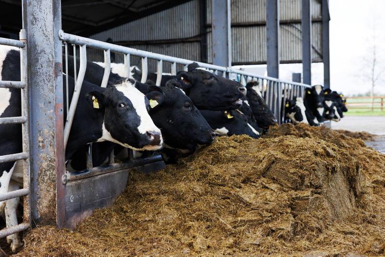
Adam Woods takes a look at housing cattle, vermin control and making sure you get paid under the BDGP and BEEP-S scheme.
Dairy
Aidan Brennan looks at grazing decisions, dry cow minerals and winter milk.
Read more
25% of consumers purchasing more organic since March
Slurry from 400,000 cows wanted for biomethane project
Friday
Rain will clear early on Friday with most areas holding dry, Met Éireann has forecasted. There will be sunny spells and scattered showers, mainly in the northwest. Highest temperatures will range from 9°C to 13°C.
By night, Friday will be wet and windy. Heaviest rain will continue across Atlantic counties overnight with some possible flooding. It will be coolest early on with lowest temperatures of 5°C to 9°C.
Saturday
Saturday will begin very wet and windy with rain soon clearing to sunshine and passing heavy showers by early afternoon. There will be a risk of hail and isolated thunderstorms later with highest temperatures of 11°C to 14°C.
It will be ool and windy on Saturday night with mainly clear spells. There will be some heavy and prolonged showers across Atlantic counties with lowest temperatures of 5°C to 8°C.
Sunday
Blustery thundery showers are expected for Sunday. Best sunshine is expected in eastern counties where it will be driest. Highest temperatures will be from 9°C to 12°C.
Further blustery showers are expected on Sunday night, mainly in the west. Lowest temperatures will range from 5°C to 7°C.
Week ahead
Next week will begin dry with quiet conditions. Current indications suggest it will turn very unsettled by midweek.
Tillage
Planting progress has been good and hopefully there will still be opportunities to get more planting done in many regions, writes Andy Doyle.
Sheep
Failing to close a sufficient area of ground at the correct timelines will result in higher feed costs next spring and a higher labour requirement, writes Darren Carty.
Beef
Adam Woods takes a look at housing cattle, vermin control and making sure you get paid under the BDGP and BEEP-S scheme.
Dairy
Aidan Brennan looks at grazing decisions, dry cow minerals and winter milk.
Read more
25% of consumers purchasing more organic since March
Slurry from 400,000 cows wanted for biomethane project


SHARING OPTIONS