The next phase of the Tellus Survey, a nationwide programme of Geological Survey Ireland, will take off over southern and central counties of Ireland in the coming days.
Tellus is a programme to collect geochemical and geophysical data on rocks, soil and water across Ireland.
“Our data will offer farmers a better insight into their soil type and its chemical makeup. This in turn will aid in improving soil fertility with the necessary data to inform fertiliser application,” senior geologist and project manager for Tellus Dr Jim Hodgson told the Irish Farmers Journal.
World leader
A low-flying airplane equipped with geophysical assessing instruments will fly over counties Laois, Tipperary, Kilkenny and Waterford, along with neighbouring parts of Offaly, Cork, Carlow and Kildare, until the end of the year.
The programme aims to have 75% of Ireland mapped by 2020, with the resulting data said to have the potential to deliver positive economic, environmental and agricultural benefits.
The data collected from the geochemical survey ... will also be used to better inform farmers about their land
Hodgson continued: “The survey will provide farmers with detailed maps locating limestone areas which are good for drilling wells.
“The data collected from the geochemical survey ‘Terra Soil’ is currently undergoing analysis by Teagasc and will also be used to better inform farmers about their land.
“When our survey is fully complete in 2023, Ireland will be the best mapped country in the world.”
Livestock
The geophysical instruments on board the plane include:
A magnetometer which measures the variations in the earth’s magnetic field. A gamma ray detector which measures the natural radioactivity of shallow soil and rocks.A frequency-domain electromagnetic system which measures variations in conductivity between different soils and rocks. Based at Waterford Airport, the survey plane will be flying at 60 metres over rural areas and 240 metres over urban areas in the coming months. All instruments are safe and do not emit any radiation.
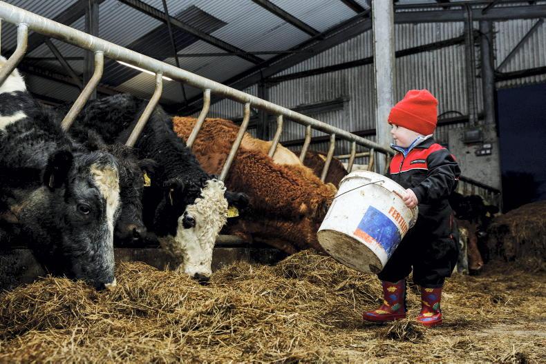
Due to the low-flying altitude of the survey aircraft, anyone concerned about sensitive livestock is encouraged to contact the Tellus freephone information line on 1800 45 55 65.
“We are asking farmers to make us aware of any horses or livestock which are easily frightened before we conduct our survey over their land. The plane flies relatively close to the ground and we’d like to avoid any unnecessary scares,” Hodgson concluded.
Data collected throughout the Tellus project is published online and made freely available to all.
The next phase of the Tellus Survey, a nationwide programme of Geological Survey Ireland, will take off over southern and central counties of Ireland in the coming days.
Tellus is a programme to collect geochemical and geophysical data on rocks, soil and water across Ireland.
“Our data will offer farmers a better insight into their soil type and its chemical makeup. This in turn will aid in improving soil fertility with the necessary data to inform fertiliser application,” senior geologist and project manager for Tellus Dr Jim Hodgson told the Irish Farmers Journal.
World leader
A low-flying airplane equipped with geophysical assessing instruments will fly over counties Laois, Tipperary, Kilkenny and Waterford, along with neighbouring parts of Offaly, Cork, Carlow and Kildare, until the end of the year.
The programme aims to have 75% of Ireland mapped by 2020, with the resulting data said to have the potential to deliver positive economic, environmental and agricultural benefits.
The data collected from the geochemical survey ... will also be used to better inform farmers about their land
Hodgson continued: “The survey will provide farmers with detailed maps locating limestone areas which are good for drilling wells.
“The data collected from the geochemical survey ‘Terra Soil’ is currently undergoing analysis by Teagasc and will also be used to better inform farmers about their land.
“When our survey is fully complete in 2023, Ireland will be the best mapped country in the world.”
Livestock
The geophysical instruments on board the plane include:
A magnetometer which measures the variations in the earth’s magnetic field. A gamma ray detector which measures the natural radioactivity of shallow soil and rocks.A frequency-domain electromagnetic system which measures variations in conductivity between different soils and rocks. Based at Waterford Airport, the survey plane will be flying at 60 metres over rural areas and 240 metres over urban areas in the coming months. All instruments are safe and do not emit any radiation.
Due to the low-flying altitude of the survey aircraft, anyone concerned about sensitive livestock is encouraged to contact the Tellus freephone information line on 1800 45 55 65.
“We are asking farmers to make us aware of any horses or livestock which are easily frightened before we conduct our survey over their land. The plane flies relatively close to the ground and we’d like to avoid any unnecessary scares,” Hodgson concluded.
Data collected throughout the Tellus project is published online and made freely available to all.


SHARING OPTIONS