Everyone wants or needs something different from our weather and our weather forecasts. While one person may want fine hot weather for making hay or
silage, harvesting, or even holidays, others may want moisture to germinate the seeds they have sown, reduce fire risk or even to maintain nutrient availability for plant growth.
While it is not possible to satisfy these opposing needs simultaneously, accurate forecasting can at least help everyone to know how to spend their day.
Met Éireann and its forecasters are well known through their daily weather forecasts. They provide specific forecasts to many individual sectors that are affected by weather.
It is important that people affected in any way by weather be aware of the many specific services provided by Met Éireann.
In this and next week’s article, Klara Finkele from Met Eireann’s AgMet Unit outlines many of these services, explains what they provide and gives the links to their web pages so that readers can check them out and judge their potential usefulness.
National forecasts
Met Éireann provides a range of forecasting services to the public, with additional focused offerings to specific interest groups. Forecasters work around the clock to provide the most up-to-date information on weather developments to enable society protect life and property.
This is most evident in times of weather warnings, where multiple national services come together to advise on actions for the safety of the general public.
Daily forecasts to the public go out via radio, television, websites (including Met Éireann’s) and a myriad of different smartphone apps.
Forecasts are both short and long term, with forecasts for today, tonight, and tomorrow updated every few hours. The following is a listing of the many different formats in which the forecast is delivered and the extent of those forecasts.
Outlook - 3-5 days: Klara said that this outlook forecast is updated early each morning and, if necessary, throughout the day. This is available on many different media but it can also be accessed on Met Éireann’s website which provides access to many other services.
Ensemble forecast with probabilistic maps: this new service is well worth a look for anyone who needs to know the amount of rainfall likely to fall as distinct from the likelihood of wet or dry weather. It is graphically easy to follow once you get your eye in. Klara explained that these short-range high-resolution forecasts show the probabilities of rainfall, minimum and maximum temperatures, high wind speeds and gusts. These maps are very useful for farmers at different times of the year because they display the chance of precipitation, the likely level of precipitation and the chance of temperatures and wind speeds going over certain thresholds for jobs like spraying (see QR code panel for link).
Location-based forecast: many people are now familiar with location-based forecasting on smartphones where the device tells the programme where the holder is located and the Met Éireann website or app will interpolate the forecast for that exact location for the next 10 days. As long as your app or website has access to your specific location, the location-based forecast will operate and the maps will automatically update. 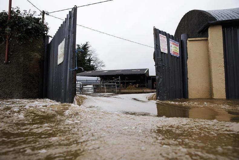
A flooded farmyard on the banks of the Blackwater river in Co Waterford. / Donal O' Leary
With this forecast, data is outputted in:
> One-hour out to 90 hours.
> Three-hour intervals from 90 to 144 hours.
> Six-hour intervals from 144 to 240 hours.
Monthly and seasonal forecasts: some may feel that the concept of a monthly forecast is likely to be of little value when the accuracy of forecasting is challenged beyond a three-day period. This as more of a probability or likelihood analysis than a forecast. but it can still be useful. It describes individual weeks in the next four as likely to be wetter or dryer or colder or warmer than normal for that week. So they can, at times, provide a very useful insight into likely weather developments in the month ahead. This forecast has proven useful at times in recent years. As we suffer periods of incessant rainfall, or the occasional prolonged dry spell, the prospect of a change in the weather in the coming month can offer hope.
Insights
While it must only be seen as a likelihood, its insights that a specific week in the future could be warmer or colder or wetter or drier than average have proven to be correct at times.
However, it is important to remember that forecasts beyond one week become increasingly uncertain due to the chaotic nature of the atmosphere, as explained previously. When there is no clarity ahead for specific weeks, it clearly states that too. It is sensible to watch this when preparing for big jobs like planting, silage, hay and harvest.
The monthly forecast is updated on Tuesdays and Fridays (see QR code panel for link). The new seasonal forecasts are also now provided at this site. This again is mainly an expression of probability as to how the weather may develop over the next three months. This is updated around the middle of the month.
Surface analysis: allied to the extended range forecast, Klara explained that a Met Éireann forecaster produces an analysis of the surface pressure and frontal situation of the atmosphere every day over Western Europe and the North Atlantic. This is available at: https://www.met.ie/latest-reports/surface-analysis. For those who understand this type of forecast, it can be a useful guide to likely weather developments in the near term.
Gale warnings: this is another new element of Met Éireann’s forecasting, which gives the likelihood of gales for three days ahead. These are also provided within the sea-area forecast, as they can potentially threaten life and the forecast enables seafarers to plan ahead. This can also be seen on the Met Éireann app. The Sea Area forecast is updated every six hours for the 24-hour detailed forecast and the 24-hour outlook.
Atlantic charts: the Atlantic charts provide a 10-day forecast of direct model output every six hours and show precipitation and pressure systems across Western Europe and the North Atlantic. Again, these can provide a very useful guide as to developing coming weather patterns (see QR code panel for link).
Everyone wants or needs something different from our weather and our weather forecasts. While one person may want fine hot weather for making hay or
silage, harvesting, or even holidays, others may want moisture to germinate the seeds they have sown, reduce fire risk or even to maintain nutrient availability for plant growth.
While it is not possible to satisfy these opposing needs simultaneously, accurate forecasting can at least help everyone to know how to spend their day.
Met Éireann and its forecasters are well known through their daily weather forecasts. They provide specific forecasts to many individual sectors that are affected by weather.
It is important that people affected in any way by weather be aware of the many specific services provided by Met Éireann.
In this and next week’s article, Klara Finkele from Met Eireann’s AgMet Unit outlines many of these services, explains what they provide and gives the links to their web pages so that readers can check them out and judge their potential usefulness.
National forecasts
Met Éireann provides a range of forecasting services to the public, with additional focused offerings to specific interest groups. Forecasters work around the clock to provide the most up-to-date information on weather developments to enable society protect life and property.
This is most evident in times of weather warnings, where multiple national services come together to advise on actions for the safety of the general public.
Daily forecasts to the public go out via radio, television, websites (including Met Éireann’s) and a myriad of different smartphone apps.
Forecasts are both short and long term, with forecasts for today, tonight, and tomorrow updated every few hours. The following is a listing of the many different formats in which the forecast is delivered and the extent of those forecasts.
Outlook - 3-5 days: Klara said that this outlook forecast is updated early each morning and, if necessary, throughout the day. This is available on many different media but it can also be accessed on Met Éireann’s website which provides access to many other services.
Ensemble forecast with probabilistic maps: this new service is well worth a look for anyone who needs to know the amount of rainfall likely to fall as distinct from the likelihood of wet or dry weather. It is graphically easy to follow once you get your eye in. Klara explained that these short-range high-resolution forecasts show the probabilities of rainfall, minimum and maximum temperatures, high wind speeds and gusts. These maps are very useful for farmers at different times of the year because they display the chance of precipitation, the likely level of precipitation and the chance of temperatures and wind speeds going over certain thresholds for jobs like spraying (see QR code panel for link).
Location-based forecast: many people are now familiar with location-based forecasting on smartphones where the device tells the programme where the holder is located and the Met Éireann website or app will interpolate the forecast for that exact location for the next 10 days. As long as your app or website has access to your specific location, the location-based forecast will operate and the maps will automatically update.
A flooded farmyard on the banks of the Blackwater river in Co Waterford. / Donal O' Leary
With this forecast, data is outputted in:
> One-hour out to 90 hours.
> Three-hour intervals from 90 to 144 hours.
> Six-hour intervals from 144 to 240 hours.
Monthly and seasonal forecasts: some may feel that the concept of a monthly forecast is likely to be of little value when the accuracy of forecasting is challenged beyond a three-day period. This as more of a probability or likelihood analysis than a forecast. but it can still be useful. It describes individual weeks in the next four as likely to be wetter or dryer or colder or warmer than normal for that week. So they can, at times, provide a very useful insight into likely weather developments in the month ahead. This forecast has proven useful at times in recent years. As we suffer periods of incessant rainfall, or the occasional prolonged dry spell, the prospect of a change in the weather in the coming month can offer hope.
Insights
While it must only be seen as a likelihood, its insights that a specific week in the future could be warmer or colder or wetter or drier than average have proven to be correct at times.
However, it is important to remember that forecasts beyond one week become increasingly uncertain due to the chaotic nature of the atmosphere, as explained previously. When there is no clarity ahead for specific weeks, it clearly states that too. It is sensible to watch this when preparing for big jobs like planting, silage, hay and harvest.
The monthly forecast is updated on Tuesdays and Fridays (see QR code panel for link). The new seasonal forecasts are also now provided at this site. This again is mainly an expression of probability as to how the weather may develop over the next three months. This is updated around the middle of the month.
Surface analysis: allied to the extended range forecast, Klara explained that a Met Éireann forecaster produces an analysis of the surface pressure and frontal situation of the atmosphere every day over Western Europe and the North Atlantic. This is available at: https://www.met.ie/latest-reports/surface-analysis. For those who understand this type of forecast, it can be a useful guide to likely weather developments in the near term.
Gale warnings: this is another new element of Met Éireann’s forecasting, which gives the likelihood of gales for three days ahead. These are also provided within the sea-area forecast, as they can potentially threaten life and the forecast enables seafarers to plan ahead. This can also be seen on the Met Éireann app. The Sea Area forecast is updated every six hours for the 24-hour detailed forecast and the 24-hour outlook.
Atlantic charts: the Atlantic charts provide a 10-day forecast of direct model output every six hours and show precipitation and pressure systems across Western Europe and the North Atlantic. Again, these can provide a very useful guide as to developing coming weather patterns (see QR code panel for link). 


 This is a subscriber-only article


SHARING OPTIONS: