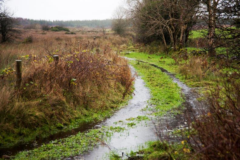
Up to 50mm of rain is expected in the south and east.
ADVERTISEMENT
The alert applies to Munster and counties Dublin, Carlow, Kildare, Kilkenny, Louth, Wexford, Wicklow and Meath all day on Thursday. Heavy rain is expected, with accumulations between 30mm and 50mm possible. This is equivalent to up to 2in of rain in 24 hours. Met Éireann has warned of a risk of local flooding.
The Met Office has issued a similar warning for Northern Ireland from 3pm on Thursday.
While not covered by the warning, the rest of the country will also receive heavy rain on Thursday. Winds will become fresh to strong and gusty late in the day.
ADVERTISEMENT
The overall forecast for the rest of this week is for very wet and windy weather.
After a cold and bright start to Friday, the weather will deteriorate with strong, gusty winds accompanied by heavy rain and again a risk of spot flooding at night. Gale-force winds are forecast at sea.
Met Éireann has so far described the next weather event as a “deepening Atlantic depression”. The next name on the list of named storms in the UK and Ireland would be Brian, but meteorologists have said that the depression expected in the coming days has so far not been classified as such.
Have you been affected by storm Ophelia? Take our survey to let us know how you’re doing.
This content is available to digital subscribers and loyalty code users only. Sign in to your account, use the code or subscribe to get unlimited access.
The reader loyalty code gives you full access to the site from when you enter it until the following Wednesday at 9pm. Find your unique code on the back page of Irish Country Living every week.
CODE ACCEPTED
You have full access to the site until next Wednesday at 9pm.
CODE NOT VALID
Please try again or contact support.
The alert applies to Munster and counties Dublin, Carlow, Kildare, Kilkenny, Louth, Wexford, Wicklow and Meath all day on Thursday. Heavy rain is expected, with accumulations between 30mm and 50mm possible. This is equivalent to up to 2in of rain in 24 hours. Met Éireann has warned of a risk of local flooding.
The Met Office has issued a similar warning for Northern Ireland from 3pm on Thursday.
While not covered by the warning, the rest of the country will also receive heavy rain on Thursday. Winds will become fresh to strong and gusty late in the day.
The overall forecast for the rest of this week is for very wet and windy weather.
After a cold and bright start to Friday, the weather will deteriorate with strong, gusty winds accompanied by heavy rain and again a risk of spot flooding at night. Gale-force winds are forecast at sea.
Met Éireann has so far described the next weather event as a “deepening Atlantic depression”. The next name on the list of named storms in the UK and Ireland would be Brian, but meteorologists have said that the depression expected in the coming days has so far not been classified as such.
Have you been affected by storm Ophelia? Take our survey to let us know how you’re doing.
If you would like to speak to a member of our team, please call us on 01-4199525.
Link sent to your email address
We have sent an email to your address. Please click on the link in this email to reset your password. If you can't find it in your inbox, please check your spam folder. If you can't find the email, please call us on 01-4199525.
ENTER YOUR LOYALTY CODE:
The reader loyalty code gives you full access to the site from when you enter it until the following Wednesday at 9pm. Find your unique code on the back page of Irish Country Living every week.


SHARING OPTIONS