

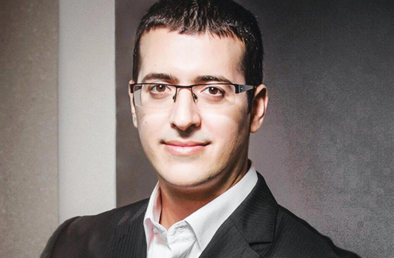
What is Taranis and what service does it offer farmers?
Taranis is an ag-tech start-up that offers precision aerial surveillance of crops and farms to help preempt crop yield loss due to insects, crop disease, weeds and nutrient deficiencies. We image crops from satellites and planes, depending on the resolution the farmer wants. Today, we’re licencing data from more than 120 different satellites, which gives us daily imagery of crops all over the world. We also offer a premium imagery service with a fleet of 75 planes and drones that are able to fly below any clouds and get much higher resolution imagery.
How does this technology help farmers?
We help the farmer in four main areas. Firstly, at the start of the season we help assess planting quality and strike rates, which allows the farmer to decide if they need to replant in some areas. Secondly, our resolution is good enough to detect weeds once the crop begins to establish. Using artificial intelligence (AI) technology, our targeting programme assesses thousands of images of crops and can show the farmer a very simplified map of where the problem area is in crops. Thirdly, in the later stages of the growing season, our technology helps the farmer assess insect and disease damage in the crop. If the farmer spots the very first symptoms of insect or disease damage, they can still address the problem before it’s too late. Finally, our imagery can detect soil deficiency in nitrogen, phosphorus, potassium and even micro elements as each will manifest differently in the crop.
How many farmers do you work with?
Taranis has been commercially active for a bit over a year now and we currently work with over 19,000 farms. Our satellite platform monitors close to 10m hectares of crops, while our premium service is now close to monitoring 1m hectares. Our biggest markets in order are the US, Brazil and Ukraine. We only started in Australia in November but I think that will be a big market for us.
How much does the service cost?
The satellite crop surveillance service is charged on a per-hectare fee which will be between $1.50/ha to $2/ha for an entire year. The additional premium services with the plane imagery will cost $1.50/ha to $2/ha per flight. Satellite imagery is great but we recommend using plane imagery between three and five times in the season to get more accurate data on the crop health. In most cases, the return on investment from using our service is three to four times.
Could this technology be used in Ireland?
Yes we think so. That’s why we’re here in Ireland to meet with Glanbia and Lakeland. We’re updating our technology to monitor grassland farms, in terms of grass density, grazing patterns and helping the farmer make decisions on when to move cows to the next paddock. The technology will also be able to inform farmers where to apply fertiliser in fields.
Title: CEO and founder.
Company: Taranis.
Location: Tel Aviv, Israel.
Sector: Ag-tech company offering precision aerial surveillance of crops.
Cropping area under surveillance: 10m hectares.
Investment funding to date: $30m.


SHARING OPTIONS